Running in Vancouver starts with the seawall: roughly 28 km of flat, car-free waterfront path, including the 9 km loop around Stanley Park that most visitors run first. Add hill repeats in Queen Elizabeth Park, soft forest trails in Pacific Spirit Regional Park and the brutally steep North Shore, and you can train for almost anything here, as long as you own a rain jacket.
This guide is for visitors with running shoes and a free morning, and for anyone planning around the 2027 Vancouver Sun Run on April 18 or the BMO Vancouver Marathon on May 2. The caveat for winter visitors: BC now stays on UTC-7 all year, so from November the mornings are darker than you might expect, with sunrise around 9:05 a.m. at the December solstice. Everything here was checked September 26, 2026 against official sources: the City of Vancouver, the race organizers and the Government of BC. For the rest of the city’s sporting calendar, see our guide to sports in Vancouver.
Running in Vancouver at a glance
| Question | Short answer |
|---|---|
| Cost | Free on every route; 2027 Sun Run entry runs C$27 to C$37 depending on when you register |
| Time needed | About 45 to 70 minutes for the Stanley Park loop at an easy pace |
| Best time | Early morning year-round; long summer evenings, when it’s light until after 9 p.m. in late June |
| Book ahead? | Only for races: Sun Run prices rise on November 1 and again on February 1 |
| What to bring | A light rain shell most of the year, and a headlamp or reflective gear for winter mornings |
Where are the best places to run in Vancouver?
These are the best places to run in Vancouver, from the obvious to the lung-busting. Distances are approximate and depend on where you join each route.
| Route | Distance | Terrain | Best for |
|---|---|---|---|
| Stanley Park seawall | 9 km loop | Flat, paved, divided path | A first run with the big views |
| False Creek seawall | About 9 km, English Bay to Vanier Park | Flat, paved | City skyline, easy add-on |
| Full seawall | Roughly 28 km | Flat, paved | Marathon training long runs |
| Kitsilano to Spanish Banks | Out-and-back along the beaches | Flat, mixed paths | Beaches and mountain views |
| Arbutus Greenway | About 8.5 km | Paved, gentle hills | A quieter run through the neighbourhoods |
| Pacific Spirit Regional Park | Loops of any length | Soft forest trails | Trail running and shade |
| Queen Elizabeth Park | Short loops | Hilly | Hill repeats |
| UBC perimeter | About 8.5 km | Roads and paths, one big hill | Ocean views and quiet streets |
| Grouse Grind | Under 3 km, straight up | Stairs and roots | A fitness test, not a run |
The Stanley Park seawall loop
The classic. The 9 km seawall around Stanley Park is flat, paved and divided, with one side for people on foot and the other for bikes and skates, and it takes most runners 45 minutes to an hour. Start at Coal Harbour, near the foot of Denman Street, and you’ll pass the marina, the totem poles at Brockton Point, the underside of the Lions Gate Bridge, Siwash Rock and Third and Second Beaches before finishing at English Bay. Go early: by late morning on a sunny weekend, the path is thick with walkers, strollers and people photographing herons.
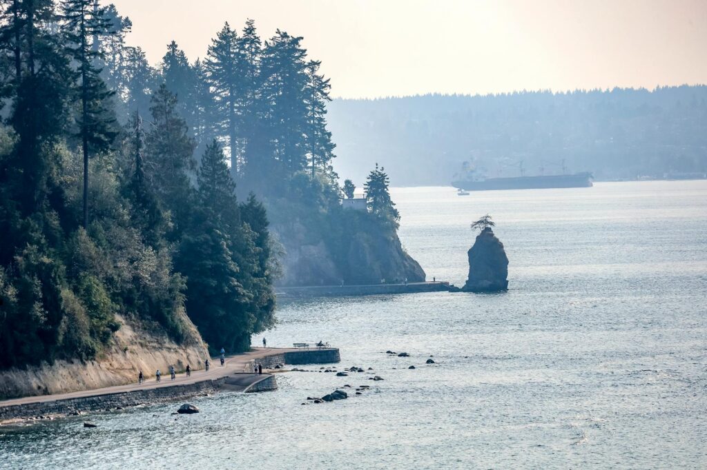
Verdict: if you only run once in Vancouver, run this, clockwise or counter-clockwise, and time it for sunrise or late afternoon light.
False Creek and the rest of the seawall
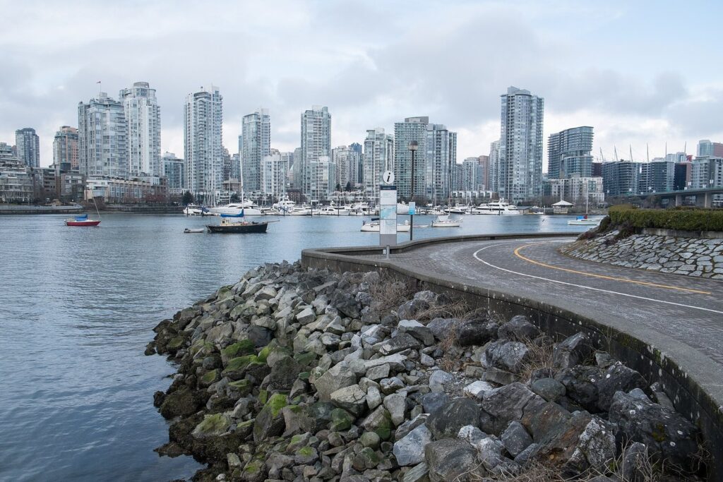
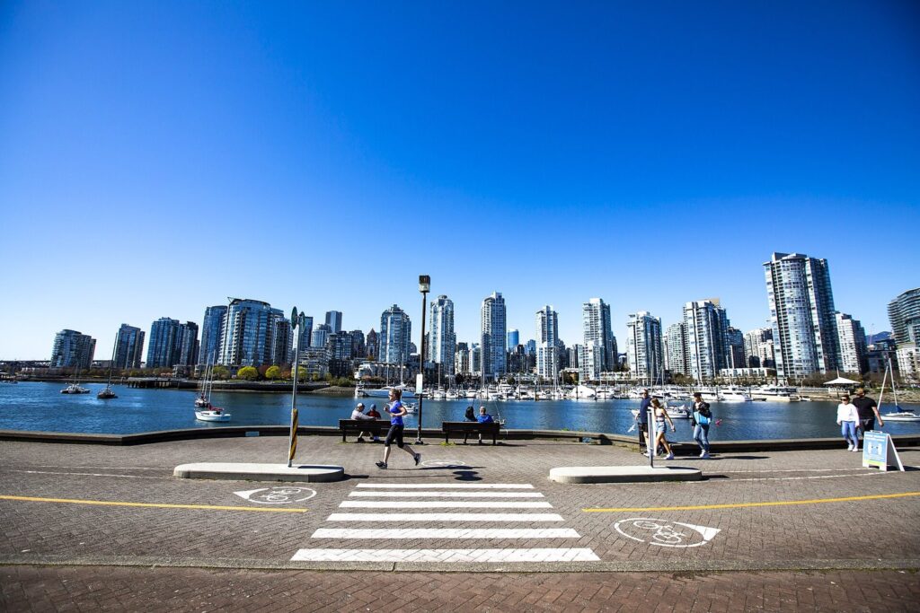
From English Bay the seawall keeps going around False Creek, past Sunset Beach, Yaletown, Science World, the Olympic Village and Granville Island to Vanier Park, about 9 km of skyline, marinas and little ferries. Link it to the Stanley Park loop and you’re close to 20 km without a traffic light worth mentioning. The Olympic Village stretch, one of the Vancouver 2010 Olympic sites, is a good place to turn around, with cafés on the square.
Kitsilano to Spanish Banks
West of Vanier Park, the route follows the shore past Kitsilano Beach, Jericho and Locarno to Spanish Banks, with the North Shore mountains across English Bay the whole way. It’s flatter and less crowded than the downtown seawall, and at low tide the sand at Spanish Banks stretches a long way out. If you’d rather pick a beach and stay, our guide to the best beaches in Vancouver compares them.
Arbutus Greenway
A car-free path of about 8.5 km that runs north to south across the city on an old rail line, from Kitsilano down toward the Fraser River. The grades are gentle, the path is paved and it’s one of the few long routes in town where you’re not dodging tourists. Cafés near the path make it an easy out-and-back.
Pacific Spirit Regional Park
The forest between the city and UBC holds a web of wide, soft trails under tall trees, ideal for easy trail running and for rainy days, when the canopy keeps off some of the weather. The trails are well signed but numerous, so carry a map on your phone; it’s easy to lose your bearings in there, and the trees all look alike after 10 km.
Queen Elizabeth Park and the hills
Vancouver’s highest point is the city’s best hill workout: short, steep loops around the Quarry Garden and up to the conservatory. In summer, finish with a Vancouver Canadians game at Nat Bailey Stadium, right next door. For longer climbs, the Point Grey hill up to UBC from Spanish Banks is a local favourite, and the UBC perimeter adds about 8.5 km of quiet roads and ocean views.
The North Shore: steep and serious
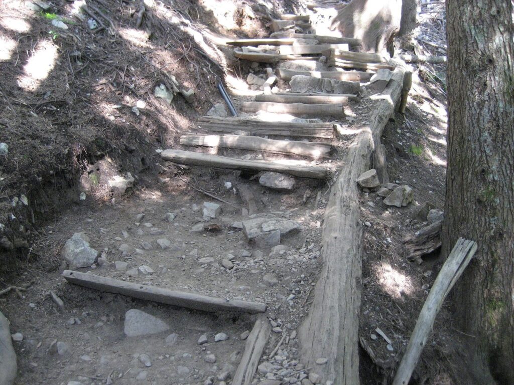
Across the harbour, the Grouse Grind in North Vancouver climbs straight up Grouse Mountain on stairs and roots. It’s a fitness test rather than a run, it’s open seasonally and it’s busy; our Grouse Grind guide covers the rules and timing. The Baden-Powell Trail and the Lynn Canyon area offer technical trail running, with the caveat that this is bear country: run with company, make noise and carry water.
Which run fits the time you have?
Distances are approximate, and every route below is flat unless it says otherwise.
- 30 minutes (about 5 km): from Coal Harbour, run the seawall out toward Brockton Point and back, or add a lap of Lost Lagoon at the park’s entrance. You’ll see the float planes, the marina and the North Shore mountains without committing to the full loop.
- An hour (about 10 km): the full Stanley Park loop from Coal Harbour to English Bay, then an easy jog back along Denman Street to where you started. It’s the route most visitors picture when they think of running here.
- 90 minutes (about 15 km): the Stanley Park loop, then carry on around False Creek past Yaletown to Science World and ride SkyTrain back from Main Street–Science World station. Tap a contactless card or phone at the fare gate; a one-zone ride costs C$3.50.
- Two hours or more (20 km-plus): the whole seawall from Canada Place toward Kitsilano, finishing at Kits Beach for a swim in summer. Buses along West 4th Avenue, or one of the little False Creek ferries from Vanier Park, get you back toward downtown.
- A trail hour: start from one of the Pacific Spirit Regional Park trailheads along West 16th Avenue or SW Marine Drive and wander the forest loops, with the map open and an eye on the time.
Can you run with a stroller or a group?
The seawall is the city’s best stroller route: flat, paved and wide, with strollers, walkers and runners sharing the pedestrian side. On sunny weekend afternoons progress slows to a shuffle, so push early. For company, many running stores and fitness brands host free weekly group runs; check their event pages before you travel, because schedules change with the seasons. Sun Run training clinics have traditionally started in the new year.
How do you share the seawall?
The seawall is the most popular recreation spot in the city, and it works because people follow a few simple rules:
- Stay on the pedestrian side. Runners belong with walkers, not in the bike lane. On the Stanley Park loop, cyclists and skaters travel one way, counter-clockwise.
- Pass on the left and look first. Walkers stop without warning to photograph a seal. Give them room and a friendly “on your left”.
- Run two abreast, not four. Group runs on a busy Sunday should string out.
- Keep one ear free. Bells, dogs and small children all deserve to be heard.
- Respect closures. In winter storms and very high tides, waves can break over sections of the seawall; when a stretch is closed, it’s closed for a reason.
When is the best time to run in Vancouver?
Year-round, which is the city’s great running secret. Winters are mild and wet rather than frozen, with daytime temperatures often around 5 to 8°C (41 to 46°F), so the seawall stays runnable while the rest of Canada is on the treadmill. Summers are dry and pleasant, with long, light evenings. The trade-offs are rain from roughly November to March and, in some summers, wildfire smoke drifting in from the interior, when it’s worth checking the air quality before a hard session.
Daylight changes a lot. With BC on UTC-7 all year from November 1, 2026, sunrise around the December solstice is about 9:05 a.m. and sunset about 5:15 p.m., so pre-work runs in December and January happen in the dark. At the June solstice it’s the reverse: sunrise around 5:05 a.m. and sunset after 9:20 p.m. Winter runners should wear reflective gear or a headlamp, especially on the unlit forest trails.
What are Vancouver’s big races?
| Race | 2027 date | Distances | Entry |
|---|---|---|---|
| Vancouver Sun Run | Sunday, April 18 | 10K | C$27 until October 31, 2026; C$32 from November 1 to January 31; C$37 from February 1 until noon on April 15 |
| BMO Vancouver Marathon | Sunday, May 2 | Marathon, marathon relay, half marathon, 8K | Set by distance and date; check the race site |
Vancouver Sun Run
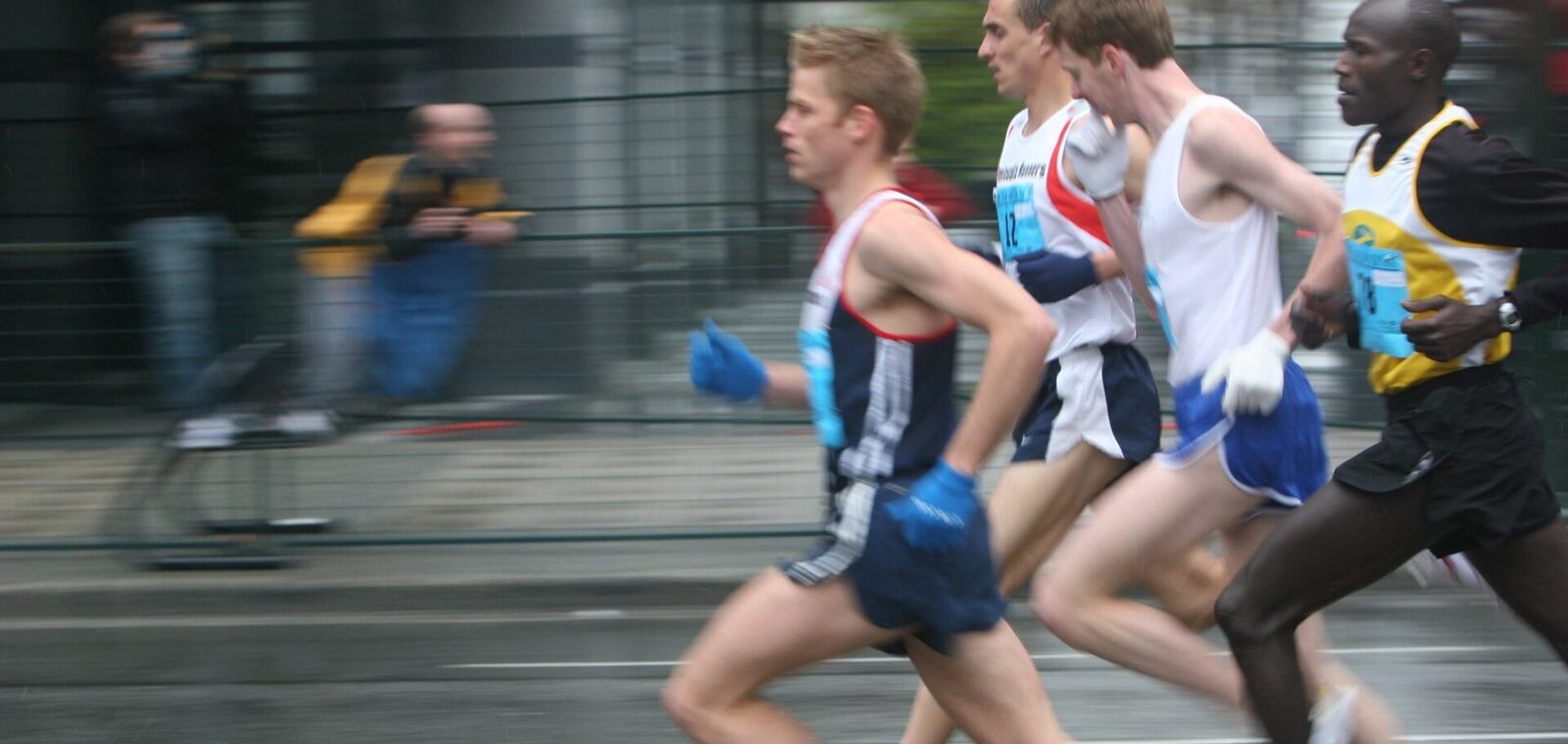
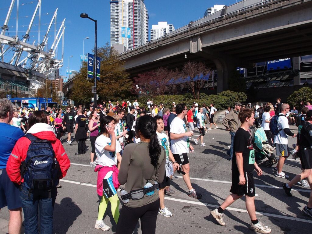
The Vancouver Sun Run is one of the biggest 10K races in North America, a spring Sunday when tens of thousands of runners, joggers and walkers take over downtown. The course has traditionally started on West Georgia Street, looped through Stanley Park and over the Burrard Bridge, and finished at BC Place. Registration for 2027 opened on September 8, 2026, and the organizers said the 2026 race sold out, so the cheapest tier, C$27 until October 31, is also the safest.
BMO Vancouver Marathon
The city’s marathon weekend falls on Sunday, May 2, 2027, with a full marathon, a marathon relay, a half marathon and an 8K. In recent years the full marathon has started in Queen Elizabeth Park and worked its way to the waterfront and Stanley Park, so the hills come early and the views come late. May weather is usually kind: cool mornings, and rain that is more of a threat than a promise.
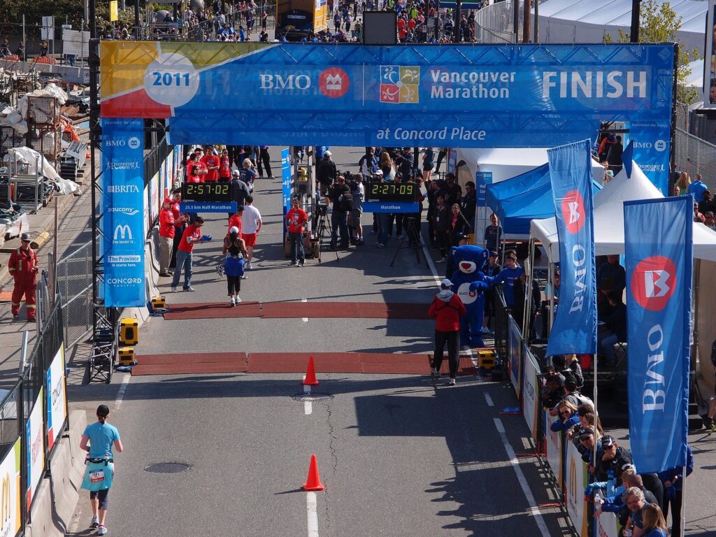
Verdict: the Sun Run is the city’s party, and the marathon is its test. If you’re travelling for one, the Sun Run is the easier sell to non-running friends: the finish is a short walk from downtown hotels, and 10 km leaves the afternoon free.
What should visiting runners know?
- Getting to the start: for the Stanley Park loop, take SkyTrain to Waterfront and pick up the seawall at Canada Place; it’s about 2 km along Coal Harbour to the park, a handy warm-up. For Kitsilano, buses along West 4th Avenue get you close to Kits Beach.
- Water and washrooms: the beaches and the main park stops have washrooms, but some drinking fountains are shut off in the colder months, so carry a bottle in winter.
- Wildlife: coyotes live in Stanley Park; give them space and never feed them. On the North Shore, bears are a real possibility.
- Safety: the seawall is busy and well used, but the forest trails get quiet after dark, so tell someone your route and save the trails for daylight.
- Walking days: for a slower look at the same routes, our guide to walking in Vancouver covers the city on foot.
Running in Vancouver FAQ
How long is the Stanley Park seawall?
The loop around Stanley Park is about 9 km, and most runners finish it in 45 minutes to an hour; walking takes two to three hours. It’s flat, paved and divided, with a pedestrian side and a bike side. The full seawall continues around False Creek and beyond for roughly 28 km in total, all of it free and open year-round.
When is the 2027 Vancouver Sun Run?
The 2027 Vancouver Sun Run is on Sunday, April 18, 2027. Registration opened September 8, 2026, with entry at C$27 until October 31, C$32 from November 1 to January 31 and C$37 from February 1 until noon on April 15. The organizers said the 2026 race sold out, so register early rather than waiting for spring.
When is the BMO Vancouver Marathon?
The 2027 BMO Vancouver Marathon is on Sunday, May 2, 2027. The weekend includes a full marathon, a marathon relay, a half marathon and an 8K, so there’s a distance for most levels. In recent years the full marathon has started in Queen Elizabeth Park; check the race site for the current course map and prices.
Is Vancouver good for running in winter?
Yes, if you don’t mind rain. Winter temperatures often sit around 5 to 8°C, snow is rare in the city and the seawall stays clear. The bigger issue is darkness: with BC on UTC-7 year-round, December sunrise is around 9:05 a.m., so morning runs start in the dark and a headlamp or reflective gear is worth packing.
Where can you run near downtown hotels?
From most downtown hotels the seawall is 5 to 15 minutes away on foot: north to Coal Harbour and Canada Place, west to English Bay or south to False Creek. From there, turn toward Stanley Park for the classic loop or toward Yaletown and Science World for the skyline. Nothing on the seawall needs a car, and SkyTrain can bring you back if your legs give out.
Where can you run hills in Vancouver?
Queen Elizabeth Park, the city’s highest point, is the go-to for short hill repeats, and the Point Grey hill from Spanish Banks up to UBC gives a longer climb. For something far steeper, the Grouse Grind in North Vancouver climbs Grouse Mountain on stairs and roots, and it’s open seasonally.
Related Vancouver guides
- Vancouver sports guide: teams, venues and the city’s sporting calendar
- Stanley Park guide: everything along and inside the seawall loop
- Grouse Grind guide: the North Shore’s famous climb
- Walking in Vancouver: the same routes at a gentler pace
- Best beaches in Vancouver: where to cool off after a long run
Sources and verification
Checked on September 26, 2026 against the city, race organizers and provincial government listed below. This guide was compiled from their published information rather than from other travel lists, and it doesn’t claim first-hand visits. Route distances are approximate.
- City of Vancouver: the seawall, Stanley Park map and guide
- Vancouver Sun Run: entry fees and deadlines
- BMO Vancouver Marathon: registration, marathon
- Government of British Columbia: permanent daylight time announcement
Photo credits
- Stanley Park Seawall: photo by Travis Kerkvliet, Pexels (Pexels License)
- False Creek seawall, 2019: photo by Paul Sableman, Wikimedia Commons (CC BY 2.0)
- Grouse Grind steps: photo by Exien, Wikimedia Commons (public domain)
- Seawall at Olympic Village, 2020: photo by GoToVan from Vancouver, Canada, Wikimedia Commons (CC BY 2.0)
- Vancouver Sun Run near BC Place: photo by Guilhem Vellut from Annecy, France, Wikimedia Commons (CC BY 2.0)
- BMO Vancouver Marathon finish, 2011: photo by Guilhem Vellut from Annecy, France, Wikimedia Commons (CC BY 2.0)
- Vancouver Sun Run lead pack, 2005 (featured image): photo by kris krüg from Vancouver, Canada, Wikimedia Commons (CC BY-SA 2.0)