Vancouver history begins thousands of years before European contact — the Squamish, Musqueam and Tsleil-Waututh Nations have lived on this land since time immemorial, and none of it was ever ceded by treaty. Europeans arrived in 1792, the modern city was incorporated on April 6, 1886, and it burned to the ground ten weeks later in a fire that took about 25 minutes. It rebuilt immediately, grew on railways and resource wealth, excluded and interned large parts of its own population, hosted Expo 86 and the 2010 Winter Olympics, and became one of the least affordable cities on earth.
This guide covers Vancouver’s history from time immemorial to 2026 — the Indigenous foundation, the founding, the fires, the exclusions, the world events and the modern city. It is the context that makes the rest of a visit legible.
Table of Contents
Vancouver History Quick Overview
Vancouver is young by world standards — younger than most European suburbs — which is part of why the pace of change here feels so extreme. Within a single long lifetime it went from a burnt-out sawmill settlement to a Pacific Rim city of millions.
- Time immemorial: Coast Salish peoples — Musqueam, Squamish, Tsleil-Waututh — on unceded territory
- 1792: Captain George Vancouver surveys Burrard Inlet; Spanish ships arrive the same summer
- 1867: “Gassy Jack” Deighton opens a saloon; Gastown begins
- April 6, 1886: the City of Vancouver is incorporated, population about 1,000
- June 13, 1886: the Great Fire destroys the city in roughly 25 minutes
- 1887: the first transcontinental passenger train arrives
- 1907: anti-Asian riots tear through Chinatown and Japantown
- 1942: Japanese Canadians are forcibly removed and interned
- 1986: Expo 86 draws over 22 million visits
- 2010: the Winter Olympics
- 2026: seven FIFA World Cup matches at BC Place
The one thing to carry with you: almost all of British Columbia, including every square metre of Vancouver, sits on land for which no treaty was ever signed. “Unceded” is not a figure of speech here — it is a live legal and political fact, and it is why land acknowledgements are read before public events across the city.
Indigenous History (Time Immemorial–1792)
People have lived here for at least 10,000 years, and archaeological evidence at c̥əsnaṌəm — a major Musqueam village site near the mouth of the Fraser, part of which lies beneath present-day Marpole — shows continuous occupation across thousands of years.
This was one of the densest non-agricultural populations anywhere on earth, and the reason is ecological. The salmon runs, shellfish beds, eulachon, cedar forests, berries and game produced enough surplus to support permanent villages, large plank houses, specialised artisans and highly stratified societies — without farming. Wealth was stored and redistributed through the potlatch, a ceremonial system of feasting and gift-giving that validated titles, names, crests and rights.
- xʷməθkʷəỵəm (Musqueam) — the Fraser River mouth and most of present-day Vancouver
- Sḥwx̲wú7mesh (Squamish) — Burrard Inlet north through Howe Sound to the Squamish Valley
- səl̤ilwətaẽł (Tsleil-Waututh) — “People of the Inlet,” the north shore of Burrard Inlet
Villages stood where the city now does, including X̄wáȳx̄way in what became Stanley Park. The potlatch was banned by the Canadian government from 1885 to 1951 — a prohibition aimed directly at the legal and economic system that held these societies together. It was practised in secret throughout.
European Arrival (1792–1886)
Captain George Vancouver sailed into Burrard Inlet in June 1792 and spent about a day there. The Spanish navigators Galiano and Valdés arrived the same summer, and the two parties met and exchanged charts — a surprisingly cordial encounter for two empires competing over the same coast. Simon Fraser came overland down the river that now bears his name in 1808.
For most of the next sixty years the area was a fur-trade and timber periphery. The Fraser Canyon Gold Rush of 1858 changed the trajectory, bringing tens of thousands of prospectors north and prompting Britain to declare the mainland Colony of British Columbia to forestall American annexation.
The settlement that became Vancouver began with sawmills on Burrard Inlet in the 1860s. In 1867 John “Gassy Jack” Deighton — a Yorkshire-born riverboat pilot and publican, nicknamed for his talkativeness — opened a saloon near the Hastings Mill, and a rough townsite grew around it. Officially Granville, universally Gastown.
Vancouver Founded (1886)
The Canadian Pacific Railway is the reason Vancouver exists in this location. When the CPR chose to extend its line past Port Moody to the deeper harbour here, land values exploded overnight and the settlement acquired a future.
CPR general manager William Van Horne named it. Granville, he decided, was inadequate for a transcontinental terminus, and he chose “Vancouver” for the recognition value of the captain’s name. The City of Vancouver was incorporated on April 6, 1886, with roughly 1,000 residents.
The CPR was granted enormous tracts of land in exchange for extending the line — roughly a quarter of the peninsula — which is why the railway’s street grid, property holdings and development decisions shaped the city’s form for a century afterward.
The Great Fire (1886)
On June 13, 1886, ten weeks after incorporation, land-clearing fires got away in high wind and swept through the new city. Most of Vancouver was destroyed in about 25 minutes. Contemporary accounts describe people running for the water and for Hastings Mill; the death toll is uncertain and was likely in the dozens.
The city council met the next day in a tent. Rebuilding began within 24 hours, and this time in brick and stone. The consequence is visible on any walk through Gastown: the handsome Victorian commercial blocks there date from the years immediately after the fire, not from the original settlement, which no longer exists in any physical form.
Vancouver’s fire department was founded in the aftermath, and the city’s insistence on masonry construction dates from the same moment.
The Railway That Made the City
The first transcontinental passenger train pulled into Vancouver on May 23, 1887, less than a year after the fire. It made the city, in a single stroke, the Pacific terminus of a route running to the Atlantic.
What followed was the logic that still drives the place: Vancouver as a transfer point between Asia and North America. CPR steamships ran to Yokohama, Shanghai and Hong Kong; grain and lumber moved west, tea and silk moved east. The port has been the city’s economic engine ever since, and it remains Canada’s largest.
It also set the demographic pattern. The railway had been built substantially by Chinese labourers, thousands of whom stayed in British Columbia when the work ended — and the province spent the next sixty years legislating against them.
Early 1900s Growth
Vancouver grew explosively in the first decades of the twentieth century, on timber, fishing, mining and the port. Stanley Park was dedicated in 1888 on a military reserve, with Indigenous residents still living inside its boundaries. Streetcar lines pushed development out into what are now Kitsilano, Mount Pleasant and Point Grey.
- 1888: Stanley Park opens, on land with existing Indigenous settlements
- 1908: the University of British Columbia is established, opening at Point Grey in 1925
- 1915: the Panama Canal opens, transforming the economics of the port
- 1929: Point Grey and South Vancouver amalgamate with the city, creating its modern boundaries
- 1938: the Lions Gate Bridge opens, privately financed by the Guinness family to open up their British Properties land on the North Shore
The Guinness detail is worth keeping: one of Vancouver’s defining landmarks exists because a brewing family needed a way to sell suburban lots.
Asian Immigration & Discrimination
This is the part of the city’s history that the heritage plaques handle least well, and it is essential to understanding several neighbourhoods.
- 1885: a $50 head tax is imposed on Chinese immigrants, rising to $500 by 1903 — roughly two years’ wages, and applied to no other group
- September 1907: a rally organised by the Asiatic Exclusion League turns into a mob that attacks Chinatown and the Japanese quarter on Powell Street
- 1914: the Komagata Maru, carrying 376 passengers from British India, is held in Burrard Inlet for two months and forced to return; 19 passengers are killed on arrival in Calcutta
- 1923–1947: the Chinese Immigration Act — the Exclusion Act — bars Chinese immigration almost entirely, separating families for a generation
- 1947: the Act is repealed and Chinese Canadians gain the federal vote
The apologies came much later: the federal government apologised for the head tax in 2006 and for the Komagata Maru in 2016, and the City of Vancouver issued its own apology for historical discrimination against Chinese residents in 2018.
Walking Chinatown with this in mind changes it completely — the family association buildings, the schools and the benevolent societies exist because the community was excluded from everything else.
World Wars & Internment
Vancouver’s wars were fought elsewhere, but the war that reshaped the city was fought here administratively.
In 1942, following Japan’s entry into the war, the Canadian government forcibly removed roughly 22,000 Japanese Canadians — the majority of them Canadian-born citizens — from a 100-mile coastal exclusion zone. They were held at Hastings Park in Vancouver, in livestock buildings, before being dispersed to interior camps, road gangs and sugar-beet farms on the prairies.
Their property was confiscated and sold to fund their own detention. Powell Street’s Japantown — a dense, established neighbourhood of homes, businesses, schools and temples — ceased to exist. Restrictions were not lifted until 1949, four years after the war ended, and many never returned.
The federal government formally apologised and made redress in 1988. Hastings Park still hosts the PNE, and a small memorial garden there marks what happened on the site.
Mid-Century Vancouver
Postwar Vancouver grew outward, around the car and the single-family house, in the pattern the Museum of Vancouver‘s 1950s gallery reconstructs. The 1960s brought something less predictable.
Kitsilano’s Fourth Avenue became the centre of a genuine West Coast counterculture — communal houses, head shops, an alternative press and a persistent low-level conflict with the police. Its most consequential export was environmental: Greenpeace was founded in Vancouver in 1971, growing out of a campaign to sail a boat into a US nuclear test zone off Alaska.
Simon Fraser University opened on Burnaby Mountain in 1965 to an Arthur Erickson design, and the city began acquiring the modernist civic architecture — Robson Square, the Museum of Anthropology — that now defines its mid-century look.
The Freeway Revolt & Hogan’s Alley
In the 1960s Vancouver planned a network of elevated freeways into and through the downtown peninsula, on the model of every other North American city. The route would have driven through Chinatown and demolished much of Strathcona.
Residents organised — Chinese Canadian community groups, Strathcona homeowners, students and planners — and between roughly 1967 and 1972 they killed it. Vancouver remains the only major North American city with no freeway running into its downtown core, and the walkable density visitors enjoy is a direct result.
The victory was partial, and it is important to say where it failed. The Georgia Viaduct was built, and building it required demolishing Hogan’s Alley, the centre of Vancouver’s Black community in Strathcona. Homes, businesses and the African Methodist Episcopal Fountain Chapel were cleared through the late 1960s and 1970s, and the community was dispersed. The City has since committed to redress and to a cultural centre on the site as the viaducts come down.
So the same era produced both outcomes: a Chinese Canadian community strong enough to stop a freeway, and a Black community too small and too politically isolated to stop the piece of it that got built.
Expo 86
The 1986 World Exposition on Transportation and Communication ran from May 2 to October 13, 1986, on the north shore of False Creek, and coincided with the city’s centennial. It drew 22,111,578 visits — far beyond projections — and it is the hinge event in modern Vancouver history.
Its legacies are physical and still in use: the SkyTrain’s first line, Canada Place with its sail roof, Science World’s geodesic dome, and BC Place. More consequentially, it introduced Vancouver to international investors at precisely the moment Hong Kong capital was looking for somewhere to go ahead of the 1997 handover.
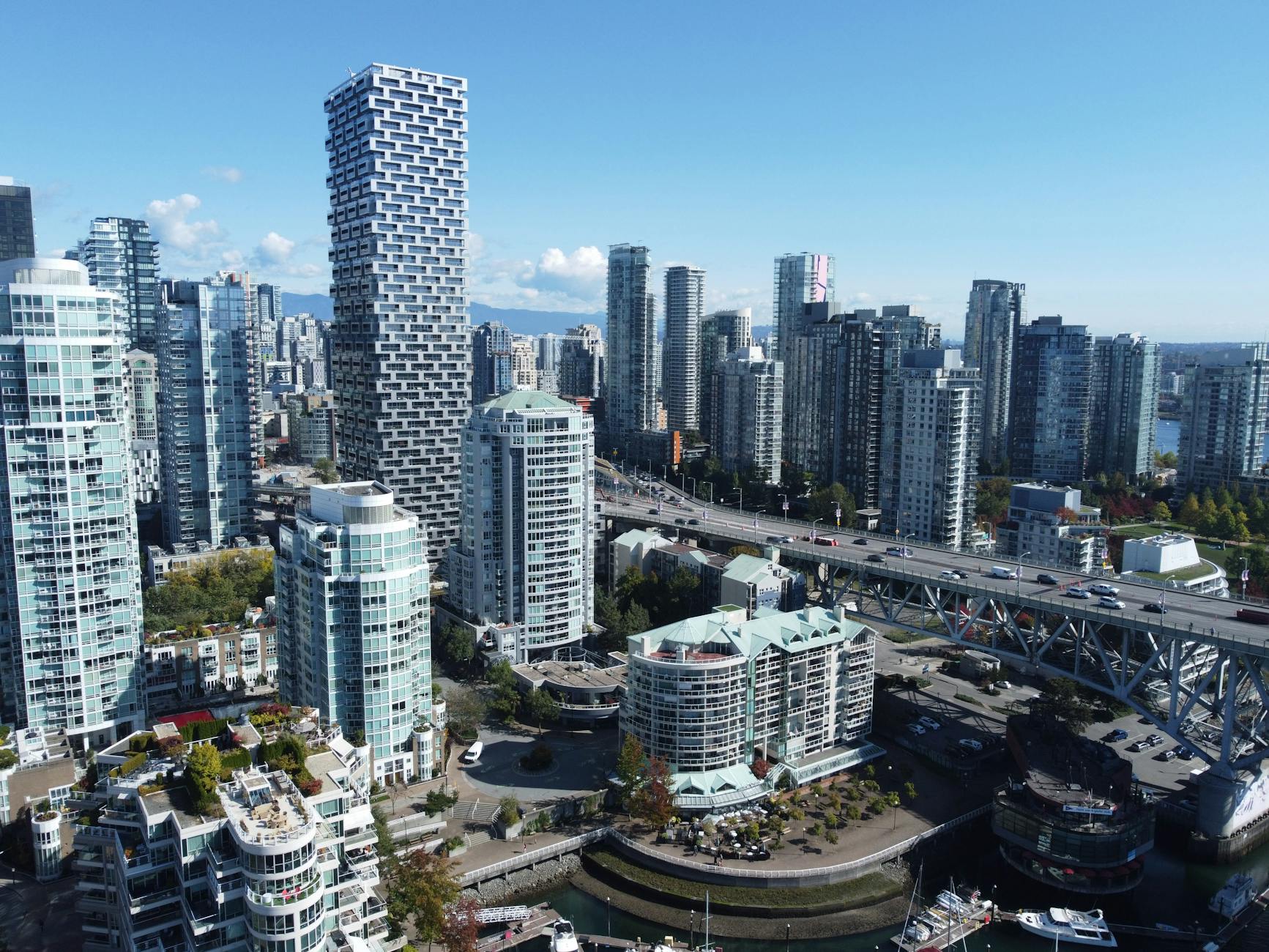
The Expo lands were sold to Hong Kong developer Li Ka-shing in 1988 in a single transaction, and the residential towers that now line False Creek — the slim glass point towers on podiums that people call “Vancouverism” — grew out of that deal. Expo also displaced hundreds of low-income residents from downtown hotels cleared for the event, a pattern of pre-event eviction repeated in 2010.
Modern Era (1990s–2010s)
The post-Expo decades turned Vancouver into a Pacific Rim city in demographic fact as well as marketing copy.
- 1997: Hong Kong’s handover accelerates migration to Vancouver, transforming Richmond and the west side
- 1990s–2000s: downtown residential densification — “Vancouverism” — makes the city an international planning reference
- 2003: Vancouver wins the 2010 Winter Olympics bid
- 2000s: the film industry earns the city the nickname “Hollywood North”
- 2010s: housing costs detach from local incomes and become the defining civic issue
The Downtown Eastside became, over the same period, the most concentrated site of poverty, homelessness and drug-related death in Canada — a few blocks from some of the most expensive real estate on the continent. North America’s first supervised injection site, Insite, opened there in 2003.
2010 Winter Olympics
The Winter Olympics ran February 12–28, 2010, with Vancouver hosting ice events and Whistler the alpine and sliding sports. The Games are remembered locally for the weather — an exceptionally warm winter that forced snow to be trucked to Cypress Mountain — and for Sidney Crosby’s overtime goal in the men’s hockey final.
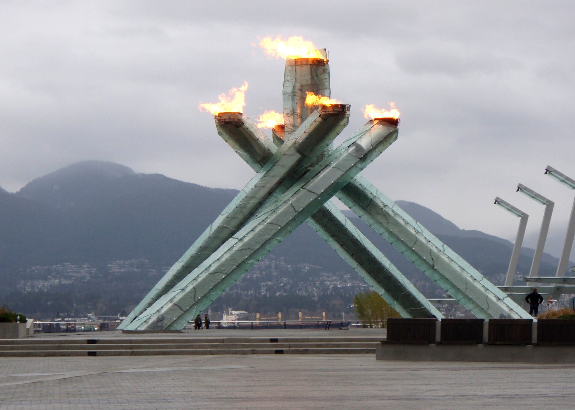
The lasting infrastructure was substantial: the Canada Line to the airport and Richmond, the upgraded Sea-to-Sky Highway, the Olympic Village that became the False Creek neighbourhood, and the Olympic Cauldron still standing at Jack Poole Plaza.
The Games also opened with a formal recognition of the four host First Nations — Musqueam, Squamish, Tsleil-Waututh and Lil’wat — as official partners, the first time an Olympics had done so. And, as with Expo, low-income residents were displaced from the downtown core in the lead-up.
2020s Vancouver
The current decade has been defined by overlapping crises and by reckoning.
- 2020–22: the pandemic empties downtown and accelerates changes to how the core is used
- 2021: the June heat dome kills hundreds across British Columbia, many of them elderly residents in un-air-conditioned apartments — the clearest local signal yet of climate risk
- 2021: the confirmation of unmarked graves at former residential school sites prompts a national reckoning; orange shirts appear across the city
- Ongoing: the toxic drug crisis, a declared public health emergency in BC since 2016, continues to kill thousands
- Ongoing: housing affordability remains the dominant political issue at every level
- 2026: Vancouver hosts seven FIFA World Cup matches at BC Place, the city’s largest event since 2010
Alongside this has come real institutional change on Indigenous relations: land acknowledgements as standard practice, major Musqueam, Squamish and Tsleil-Waututh development projects reshaping parts of the city, and the Squamish Nation’s Seńákw project beside the Burrard Bridge — one of the largest Indigenous-led developments in Canadian history, built on reserve land the Nation was evicted from in 1913.
Pair with Heritage Sites
History reads better on the ground. The sites that carry it:
- Gastown — post-1886-fire brick blocks, the Gassy Jack site and the steam clock
- Chinatown — the head tax and Exclusion Act era, and the Sam Kee Building
- Museum of Vancouver — the single best overview, especially the 1950s and 1960s galleries
- Stanley Park and Brockton Point — the park’s Indigenous history and the 2009 Rose Cole Yelton Memorial Pole
- Hastings Park — the Japanese Canadian internment site, with a memorial garden
- Strathcona — the neighbourhood the freeway would have destroyed, and the Hogan’s Alley site
- Museum of Anthropology, UBC — the deep Indigenous history, including c̥əsnaṌəm
Related Vancouver guides
Keep planning with these guides:
- Museum of Vancouver: City Stories Told Well (2026)
- Gastown Walking Guide (2026)
- Chinatown Vancouver Heritage Walk (2026)
Vancouver History FAQs
When was Vancouver founded?
The City of Vancouver was incorporated on April 6, 1886, with about 1,000 residents. The settlement that preceded it, Granville — universally called Gastown — grew from 1867 around a saloon opened by John “Gassy Jack” Deighton near the Hastings Mill.
Why is it called Vancouver?
CPR general manager William Van Horne chose the name for the railway’s Pacific terminus, after Captain George Vancouver, who surveyed Burrard Inlet in 1792. He considered “Granville” inadequate for a transcontinental terminus.
What was the Great Vancouver Fire?
On June 13, 1886, ten weeks after incorporation, land-clearing fires spread in high wind and destroyed most of the city in roughly 25 minutes. Council met in a tent the next day, and rebuilding began within 24 hours — this time in brick, which is why Gastown’s heritage blocks date from just after the fire rather than before it.
Whose land is Vancouver on?
The unceded traditional territories of the Musqueam, Squamish and Tsleil-Waututh Nations, all Coast Salish peoples. No treaty was ever signed for this land, which is why “unceded” appears in land acknowledgements across the city — it is a legal fact, not a formality.
What was Expo 86?
The 1986 World Exposition on Transportation and Communication, held on False Creek from May 2 to October 13, 1986, coinciding with Vancouver’s centennial. It drew 22,111,578 visits and left the SkyTrain, Canada Place, Science World and BC Place. The Expo lands were sold to Hong Kong developer Li Ka-shing in 1988, triggering the False Creek tower boom.
Why does Vancouver have no freeway downtown?
Because residents stopped it. A 1960s plan for elevated freeways through Chinatown and Strathcona was defeated by community organising between roughly 1967 and 1972. Vancouver is the only major North American city with no freeway into its downtown core, and its walkability is a direct consequence.
What happened to Japanese Canadians in Vancouver?
In 1942 roughly 22,000 Japanese Canadians, most of them Canadian-born citizens, were forcibly removed from the coast. They were held at Hastings Park before dispersal to interior camps, and their property was confiscated and sold to pay for their own detention. Powell Street’s Japantown was destroyed. Restrictions ended only in 1949; federal redress came in 1988.
What was Hogan’s Alley?
The centre of Vancouver’s Black community in Strathcona, demolished through the late 1960s and 1970s for the Georgia Viaduct — the one piece of the defeated freeway plan that was actually built. The City has since committed to redress and a cultural centre on the site.
What was the head tax?
A tax imposed only on Chinese immigrants, starting at $50 in 1885 and rising to $500 by 1903 — about two years’ wages. It was followed by the Chinese Immigration Act of 1923, which barred Chinese immigration almost entirely until 1947. The federal government apologised in 2006.
How old is Vancouver compared to other cities?
Very young. Incorporated in 1886, it is younger than Chicago, San Francisco and Toronto, and vastly younger than any European city. Coast Salish occupation of the same ground, however, goes back at least 10,000 years.
What is Seńákw?
A large Squamish Nation development beside the Burrard Bridge, one of the biggest Indigenous-led housing projects in Canadian history. It is being built on reserve land from which the Squamish were evicted in 1913 — the site’s return and redevelopment is among the most concrete pieces of reconciliation visible in the city.
Where can I learn about Vancouver history in person?
The Museum of Vancouver in Vanier Park is the best single overview. Add Gastown and Chinatown on foot, the Museum of Anthropology at UBC for the deep Indigenous history, and Hastings Park for the internment memorial.
Related reading: Pair this with our Vancouver culture and history pillar and our Stanley Park totem poles guide.
Photo Credits
- Vancouver Olympic Cauldron burning in 2010: Cauldron at Convention Centre by Christine Rondeau, CC BY 2.0, via Wikimedia Commons.