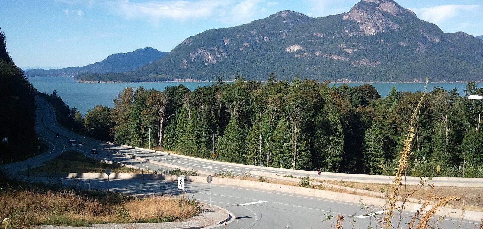
The best road trips from Vancouver fall into three families. North, the Sea to Sky Highway climbs to Squamish and Whistler and can loop back through Pemberton, Lillooet and the Fraser Canyon. West, BC Ferries carries you to the Sunshine Coast, the Gulf Islands and Vancouver Island, where the road ends at the surf beaches of Tofino. East, long highways cross the interior to the Okanagan’s lakes and vineyards and on to the Rockies at Banff and Jasper. Match the trip to your days: two or three for the Sea to Sky or the Sunshine Coast, four to six for Vancouver Island, and a week or more for the Rockies.
This guide is for visitors adding a few days beyond the city and for anyone planning a longer BC loop from Vancouver. The caveat that matters this time of year: from October 1, winter tires are legally required on most BC highways, and conditions on the mountain passes change fast. Every rule, fee and closure below was checked September 25, 2026 against official sources. For single-day outings, see the day trips from Vancouver guide; this one is about the trips that need a suitcase.
What’s closed or different right now?
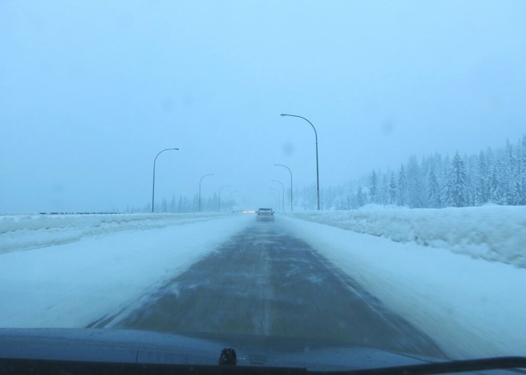
- Winter tires are required from October 1. On most BC highways, including the Sea to Sky and the Coquihalla, winter tires or chains are mandatory from October 1 to April 30; a few lower routes end the requirement on March 31. Drivers who don’t comply can be turned back and fined. If you’re renting, confirm the car qualifies before you leave the lot.
- Jasper is open, with gaps. Most of Jasper National Park and virtually all its trails have reopened since the 2024 wildfire, and the town has been welcoming visitors since September 2024. But Maligne Canyon and Cavell Road stay closed for the 2026 season, as do Wabasso Campground, Whirlpool Group Campground and part of Wapiti Campground.
- The free national park summer is over. Parks Canada’s free-admission Canada Strong Pass ran from June 19 to September 7, 2026. Regular fees resumed September 8: in Banff, C$12.25 a day for an adult or C$24.50 for a family or group in one vehicle.
- Shoulder-season schedules. From mid-October, seasonal roads such as Mount Revelstoke’s summit parkway and Yoho’s Takakkaw Falls road close for winter, ferries move to off-season timetables, and some small-town hotels and restaurants shut until spring. Check before you commit to a remote overnight.
Road trips from Vancouver at a glance
| Road trip | Days | Driving (one way or loop) | Ferries | Best season |
|---|---|---|---|---|
| Sea to Sky and the Duffey Lake loop | 2 to 3 | About 580 km loop | None | June to September |
| Sunshine Coast | 2 to 3 | About 150 km of highway | Two short crossings | May to October |
| Vancouver Island and Tofino | 4 to 6 | About 700 km loop | Two major crossings | Year-round; storms in winter |
| Gulf Islands | 2 to 4 | Short island roads | From Tsawwassen | May to September |
| Okanagan | 3 to 4 | About 390 km, 4 hours each way | None | June to October |
| Banff and the Rockies | 7 to 10 | About 850 km, 9 to 10 hours each way | None | June to September |
| Jasper and the Icefields Parkway | 7 to 10 | About 800 km, 9 hours each way | None | June to September |
| Seattle and Portland | 3 to 5 | About 510 km, 5.5 to 6 hours plus the border | None | Year-round |
How do you choose the right road trip?
Start with the number of days, then the season, then whether you want to deal with ferries. A few rules of thumb help:
- Keep driving days to five or six hours. BC’s highways are two-lane for long stretches, mountain passes are slow, and the scenery makes you stop. A route that’s nine hours on a map is a two-day drive in practice.
- Ferries add time, not just distance. Budget an hour at the terminal on top of each crossing in summer, and reserve on busy weekends.
- Season rules the interior. The Rockies and the high passes are at their best from late June to mid-September. From October to April, the coast routes and Vancouver Island are the easier, safer choices.
- Loops beat out-and-backs. Most trips below can be driven as a circuit, so you see new country on the way home.
If you only have one extra day, the Vancouver to Whistler and Squamish from Vancouver guides cover the Sea to Sky as a day trip.
Is the Sea to Sky Highway worth a multi-day trip?
Yes, and it’s the easiest BC road trip to start: Highway 99 leaves the North Shore at Horseshoe Bay and hugs the cliffs above Howe Sound, a fjord lined with mountains, before climbing inland to Whistler. Whistler is about 120 km and two hours from downtown without stops. A Sea to Sky Highway road trip is best done slowly, with a night in Whistler and, in summer, a return by the back roads.
Howe Sound and Squamish
The first hour packs in the most. Porteau Cove’s beach and pier sit right on the water, Britannia Beach has a former copper mine turned museum, and Squamish, 45 minutes from Vancouver, has Shannon Falls, the granite wall of the Stawamus Chief and the Sea to Sky Gondola, which lifts you above the fjord to a suspension bridge and viewpoints. Squamish is also the region’s climbing, mountain-biking and kiteboarding town, and it’s cheaper to sleep in than Whistler.
Whistler
Whistler village is a car-free resort town with two mountains above it. In summer, the gondolas carry hikers and sightseers instead of skiers, and the Peak 2 Peak Gondola links Whistler and Blackcomb mountains. The Squamish Lil’wat Cultural Centre, run by the two Nations whose shared territory this is, is the essential rainy-day stop, with admission at C$25. Brandywine Falls, a short walk off the highway just south of the village, is worth the stop in any weather. The Vancouver and Whistler itinerary shows how to split the days.
Pemberton, Duffey Lake and the Fraser Canyon
North of Whistler, the road drops into the farm valley of Pemberton, then climbs steeply east on the Duffey Lake Road, a section of Highway 99 with grades of up to 13% and some of the finest mountain-lake scenery in the province. Joffre Lakes, just off the road, is the famous hike here (the best hikes near Vancouver guide rates the region’s harder trails); it has required a free BC Parks day-use pass in peak season and has had closures agreed with the Lil’wat and N’Quatqua Nations, so check BC Parks before you go. The highway ends at Lillooet, a dry river town that was Mile 0 of the gold-rush wagon road. From there, Highway 12 follows the Fraser to Lytton and Highway 1 runs south through the Fraser Canyon to Hope, and home. The whole loop is about 580 km.
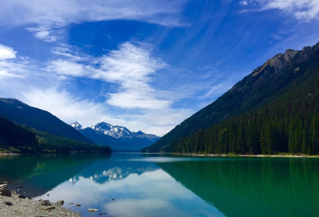
Verdict: the best short road trip in the province. Do the Duffey Lake loop between June and September; in winter, stop at Whistler and come back the same way, and see skiing Whistler from Vancouver for the ski-season logistics.
What’s the Sunshine Coast road trip like?
The Sunshine Coast is a strip of coast north of Vancouver with no road connection to the city, which is precisely its charm. A Sunshine Coast BC road trip starts with a 40-minute ferry from Horseshoe Bay to Langdale, then follows Highway 101 through Gibsons, Roberts Creek, Sechelt and Pender Harbour, a string of small, arty communities with beaches, bakeries and waterfront pubs.
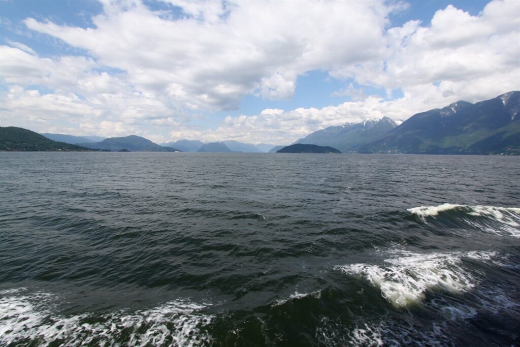
Near the end of the lower coast, Skookumchuck Narrows Provincial Park has a walking trail to tidal rapids that roar through a channel when the tide turns; time your visit to the tide tables. From Earls Cove, a second ferry of about 50 minutes crosses Jervis Inlet to Saltery Bay and the upper coast around Powell River, a mill town with lakes, a long hut-to-hut hiking trail and a relaxed pace. From Powell River, another ferry crosses to Comox on Vancouver Island, turning the trip into a grand loop home via Nanaimo.
Verdict: the lowest-effort escape from the city, and good in shoulder season when the beaches are empty. Reserve the Langdale ferry on summer weekends. For an even shorter taste of island life, Bowen Island is 20 minutes from Horseshoe Bay.
How do you plan a Vancouver Island road trip?
Vancouver Island is bigger than most visitors expect: about 450 km long, with Victoria at its southern tip, Nanaimo in the middle of the east coast and the open Pacific on the far side at Tofino and Ucluelet. A classic Vancouver Island road trip is a loop of about 700 km and four to six days: ferry to Victoria, drive north through the Cowichan Valley to Nanaimo, cross the island to the west coast, then ferry home from Nanaimo.
Victoria and the Cowichan Valley
The Tsawwassen to Swartz Bay ferry takes about 1 hour 35 minutes, and Victoria is roughly 30 minutes beyond the terminal. The capital deserves at least a night for its Inner Harbour, museums and gardens; the Vancouver to Victoria guide covers the crossing in detail. North of the city, Highway 1 climbs over the Malahat into the Cowichan Valley, a region of small wineries, cideries and farm stands, before reaching Nanaimo.
Across to Tofino and Pacific Rim National Park
From Parksville, Highway 4 heads west across the island. It passes Cathedral Grove, a stand of giant old-growth Douglas firs right beside the road, then winds through mountains and along lakes to the west coast, about three hours from Nanaimo. At the end, Pacific Rim National Park Reserve’s Long Beach unit stretches between Ucluelet and Tofino: kilometres of surf beach, rainforest boardwalks and headlands, with Parks Canada admission required. Tofino is the surf town; Ucluelet, 40 minutes south, is quieter and has the Wild Pacific Trail along its rocky shore. From November to February, storm-watching season brings huge waves and lower hotel rates.
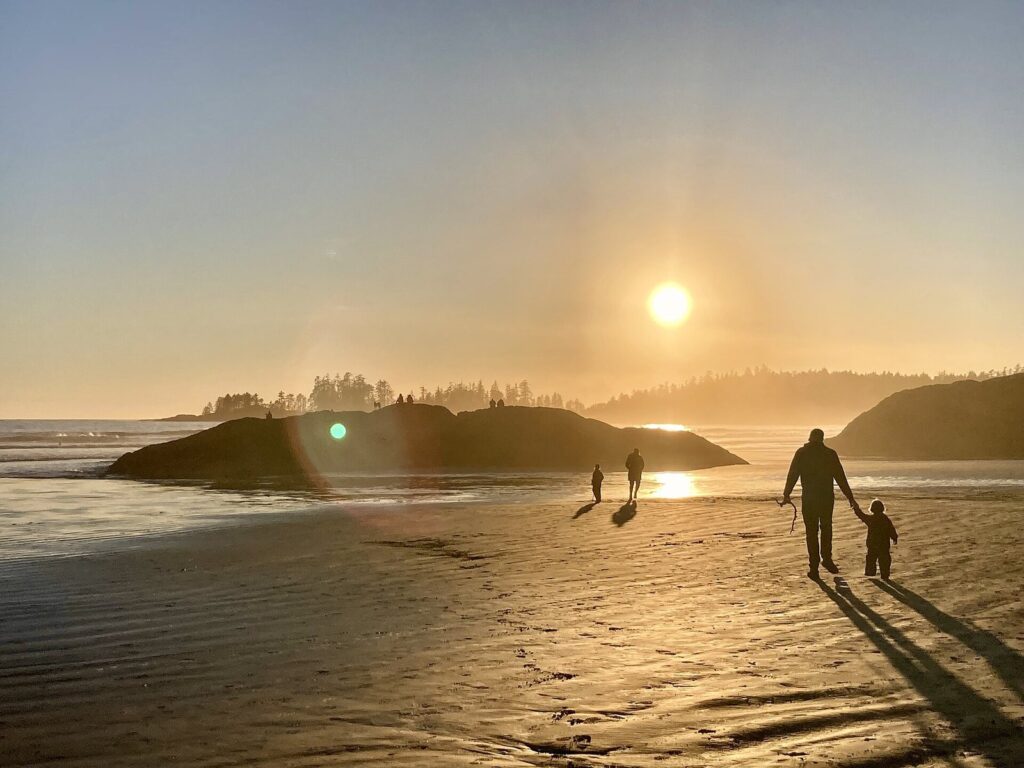
Drive Highway 4 in daylight: it’s narrow and twisting, with steep drop-offs in places, and slow trucks and campers are common in summer. For the direct route and timings, see Vancouver to Tofino.
Verdict: the best all-season road trip from Vancouver. Five days lets you give Victoria and Tofino two nights each without rushing.
How do you visit the Gulf Islands from Vancouver?
The Southern Gulf Islands, scattered between the mainland and Vancouver Island, are the slow-travel option: Salt Spring, Galiano, Mayne, Pender and Saturna each have a handful of small roads, farm stands, artists’ studios and quiet coves. Getting to the Gulf Islands from Vancouver means a BC Ferries sailing from Tsawwassen, and because some routes stop at several islands, crossings can run anywhere from under an hour to a few hours. Reservations are strongly advised in summer. If you don’t need a car, Harbour Air’s floatplanes fly from downtown to Ganges, on Salt Spring, in about 30 minutes.
Salt Spring is the busiest and easiest, with the most places to eat and stay and a well-known Saturday market in Ganges in season. Galiano and Pender suit hikers and kayakers, and Saturna is the most remote. Two or three nights on one island is better than rushing between several, because inter-island connections are limited.
Verdict: for couples and anyone who wants to slow down; less rewarding if you want a lot of sights.
How do BC Ferries fit into a road trip?
Taking BC Ferries from Vancouver is part of any trip west, and the crossings are scenic enough to count as sightseeing. The main routes from the Vancouver area:
| Route | For | Crossing time | Reserve? |
|---|---|---|---|
| Tsawwassen to Swartz Bay | Victoria | About 1 hour 35 minutes | Yes, in summer and on long weekends |
| Horseshoe Bay to Departure Bay | Nanaimo, Tofino | About 1 hour 40 minutes | Yes, in summer |
| Tsawwassen to Duke Point | Nanaimo, Tofino (from the south) | About 2 hours | Recommended |
| Horseshoe Bay to Langdale | Sunshine Coast | About 40 minutes | Yes, on busy weekends |
| Earls Cove to Saltery Bay | Powell River | About 50 minutes | Usually not |
| Tsawwassen to Southern Gulf Islands | Salt Spring, Galiano, Mayne, Pender | Under 1 hour to several hours | Yes, in summer |
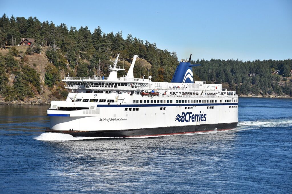
Fares depend on the route, the sailing, your vehicle’s length and height, and the number of passengers, and a reservation adds a fee but guarantees your spot. Without one, on a summer Friday or a long weekend, you can wait several sailings. Oversized vehicles such as campervans and cars with roof boxes pay more, so declare the right size when booking. Arrive at the terminal at least 30 to 45 minutes before your sailing, and keep an eye on BC Ferries’ service notices, since mechanical problems and weather occasionally cancel sailings.
Is the drive to the Okanagan worth it?
For wine, warm lakes and summer heat, yes. The Okanagan Valley, in BC’s southern interior, is a chain of lakes lined with orchards, vineyards and beaches, and it’s the province’s summer playground. The drive from Vancouver to Okanagan wine country takes about four hours to Kelowna on the fastest route: Highway 1 to Hope, the Coquihalla (Highway 5) over the mountains to Merritt, then the Okanagan Connector (Highway 97C). The Coquihalla climbs to about 1,240 m, so in winter it’s a serious mountain highway, not a commute.
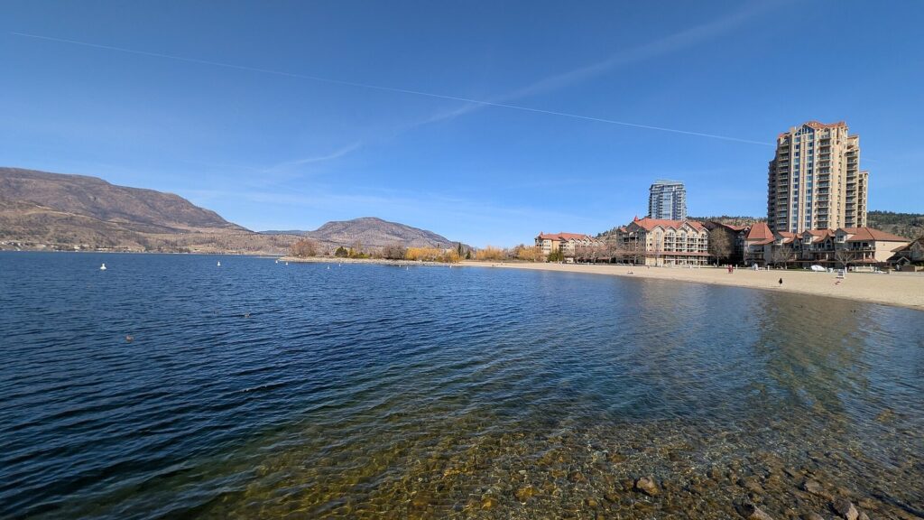
The slower, more scenic alternative is Highway 3, which runs east from Hope through Manning Park and the Similkameen Valley to Osoyoos at the south end of the Okanagan, in about four and a half to five hours. Drive in one way and out the other for a loop. In the valley, Kelowna is the biggest city, with beaches and a busy waterfront; Penticton sits between two lakes; the Naramata Bench is lined with wineries above the lake; and Oliver and Osoyoos, in the hot, dry south, grow much of the valley’s red wine.
Summer here means 30 °C-plus days, busy beaches and, in some years, wildfire smoke from July into September. September and early October are the sweet spot: harvest season, warm days and fewer crowds.
Verdict: a great three- or four-day trip from June to October. In winter, the valley is quiet except for its ski hills.
How long does a Vancouver to Banff road trip take?
Banff is about 850 km from Vancouver, or nine to ten hours of driving without stops, and nobody should do it in one day. A Vancouver to Banff road trip works best as two days each way with at least three days in the Rockies. The usual route is Highway 1 to Hope, the Coquihalla to Kamloops, then the Trans-Canada east through Salmon Arm, Revelstoke, Rogers Pass and Golden to Lake Louise and Banff.
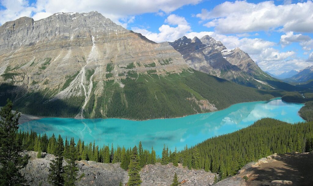
The drive itself crosses four national parks. Mount Revelstoke has a summit road to alpine meadows in summer, Glacier National Park surrounds Rogers Pass, and Yoho, just over the Alberta border, has Emerald Lake and, in summer, Takakkaw Falls. Revelstoke and Golden are the natural overnight stops. Banff and Jasper are on Mountain time, an hour ahead of Vancouver, and so is Golden in BC’s East Kootenay.
Once there, plan around Parks Canada’s rules. Stopping anywhere in a national park requires a pass, and the annual Discovery Pass pays for itself at about seven days:
| Parks Canada admission (from Sept 8, 2026) | Daily | Annual Discovery Pass |
|---|---|---|
| Adult (18 to 64) | C$12.25 | C$83.50 |
| Senior (65+) | C$10.75 | C$71.50 |
| Family or group (up to 7 in one vehicle) | C$24.50 | C$167.50 |
| Youth (17 and under) | Free | Free |
Moraine Lake is closed to private cars, so reach it by Parks Canada shuttle or a commercial bus, and expect parking fees and early-morning crowds at Lake Louise in summer. For the drive home, consider a loop south through Kootenay National Park and Radium Hot Springs, then west across the Kootenays on Highway 3 to Osoyoos and the Okanagan, which adds a couple of days and a lot of scenery.
Verdict: one of the great drives in North America, but only worth it with seven days or more. With less time, fly to Calgary and drive 90 minutes to Banff.
Is Vancouver to Jasper a better drive?
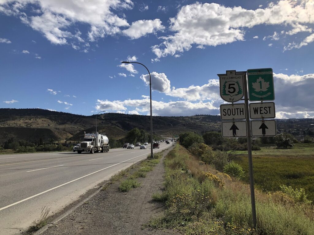
It’s quieter and wilder. The route from Vancouver to Jasper, about 800 km and nine hours, takes the Coquihalla to Kamloops, then Highway 5, the Yellowhead, north through the North Thompson valley to Clearwater, the gateway to Wells Gray Provincial Park’s waterfalls, and on past Valemount to Mount Robson, the highest peak in the Canadian Rockies at 3,954 m. Jasper town is an hour beyond.
Jasper National Park is recovering from the 2024 wildfire, and most of it is open, but for 2026 Maligne Canyon and Cavell Road remain closed, along with several campgrounds. Burned forest is visible along some roads. Check Parks Canada’s “what’s open” map before you book a campsite or plan a specific hike.
The best version of this trip is a loop: drive to Jasper, take the Icefields Parkway (Highway 93) 230 km south past the Columbia Icefield to Lake Louise and Banff, then return west on Highway 1. The parkway has almost no services and no mobile coverage for long stretches, so fill up before you set off. Allow eight to ten days for the full circuit.
Verdict: better than the Banff route alone if you have ten days to do both. In winter, leave the Icefields Parkway to experienced winter drivers.
What about a road trip to Seattle and Portland?
A Vancouver to Portland road trip is the easy international option: about 510 km on Interstate 5, five and a half to six hours of driving plus the border. Seattle, 230 km south, is the natural overnight halfway, and there are good detours on the way: Chuckanut Drive’s coastal curves near Bellingham, the Skagit Valley’s tulip fields in April, and, beyond Portland, the waterfalls of the Columbia River Gorge. Note that Portland’s neighbour across the river is Vancouver, Washington, a different city from the one you started in.
The border is the variable. Check live wait times before leaving, and avoid Sunday afternoons and long weekends heading south; the Vancouver to Seattle guide covers the crossings. Visitors who aren’t Canadian or American should confirm US entry requirements for land arrivals before setting off. Most major rental companies allow cars into the US, but check your contract, and expect a steep fee if you drop the car in Portland. Remember the clocks: from November 1, 2026 to March 14, 2027, Seattle and Portland run an hour behind Vancouver, because BC no longer falls back and the US still does.
Verdict: a good three- to five-day city trip in any season, and the easiest road trip to do without mountain driving.
What do good road trip itineraries look like?
Three tested shapes, from short to long. Distances are approximate and driving times exclude stops.
Five days on the coast
Take the morning ferry from Tsawwassen to Swartz Bay and spend two nights in Victoria. On day three, drive the Malahat and the Cowichan Valley to Parksville, then cross the island on Highway 4 through Cathedral Grove to Tofino, about four and a half hours with stops. Spend day four on Long Beach and the rainforest trails of Pacific Rim, and on day five drive three hours back to Nanaimo for the Departure Bay ferry to Horseshoe Bay. For a grander loop, start instead with the Sunshine Coast and the Powell River ferry to Comox, and add two days.
Ten days in the Rockies
- Day 1: Vancouver to Revelstoke via the Coquihalla and Kamloops, about 565 km. It’s the longest day, so leave early.
- Day 2: Over Rogers Pass to Golden and through Yoho to Lake Louise, stopping at Emerald Lake.
- Days 3 and 4: Banff, Lake Louise and the Bow Valley Parkway. Stay in Canmore, just outside the national park, if Banff’s hotels are full or too dear.
- Day 5: The Icefields Parkway to Jasper, 230 km that fill a whole day with viewpoints.
- Day 6: Jasper, with the 2026 closures in mind.
- Day 7: West past Mount Robson and south to Clearwater and Wells Gray’s waterfalls.
- Days 8 and 9: Through Kamloops to the Okanagan for lakes and wineries.
- Day 10: Kelowna to Vancouver on the Coquihalla, about four hours.
Three days in wine country
Leave Vancouver on Highway 1 and turn onto Highway 3 at Hope, climbing through Manning Park and down the Similkameen Valley to Osoyoos and Oliver for the first night. On day two, work north through the wineries of Oliver, the Naramata Bench and Penticton to Kelowna, with a designated driver or a local wine-tour shuttle doing the driving. On day three, take the Okanagan Connector and the Coquihalla home in about four hours. If you want a gentler start, the Fraser Valley has wineries and farm stops within an hour of the city.
Can you do these trips without a car?
Some of them, easily. Victoria and the Gulf Islands work well as a foot passenger: walk onto the ferry and use local buses, taxis or bikes on the other side, or skip the ferry altogether with a floatplane or a scheduled helicopter from downtown Vancouver to Victoria’s harbour. Scheduled buses run up the Sea to Sky to Squamish and Whistler year-round, and to Kelowna in the Okanagan. Tofino has scheduled flights from YVR’s South Terminal, which turn a long drive into under an hour in the air.
For the Rockies, two trains do the job in style. VIA Rail’s Canadian runs from Vancouver to Jasper and beyond, overnight in a sleeper if you want one, and the Rocky Mountaineer runs daytime-only luxury trips to Banff, Lake Louise and Jasper in season, stopping overnight in Kamloops so you see all the scenery. Neither is cheap, but both remove the two long driving days each way. And if you’d rather have someone else handle a single long day, the Vancouver tours guide covers guided trips to Whistler and Victoria.
Where should you stay along the way?
On every route, the first question is availability rather than price. In July and August, hotels in Tofino, Whistler, Banff, Jasper and the Okanagan towns can be full weeks or months ahead, and campgrounds in provincial and national parks fill almost as soon as reservations open. Book the fixed points of your trip first, then fill in the driving days around them.
- Sea to Sky: Squamish is cheaper than Whistler and only 45 minutes from it; Pemberton has a few small inns.
- Vancouver Island: Ucluelet is usually cheaper and quieter than Tofino. Winter storm-watching season brings the best rates on the west coast.
- Rockies: Revelstoke and Golden make good first nights. Canmore, just outside Banff National Park, has more choice and lower prices than Banff itself.
- Okanagan: Kelowna has the most hotels; Penticton and Osoyoos have lakeside motels and resorts that book up for summer weekends.
Shoulder seasons change the picture: in September and early October, the same rooms are easier to get and often cheaper, while the weather in the interior is still settled.
What should you know about driving in BC in fall and winter?
BC’s highways are well maintained, but the mountain routes demand respect from October to April. The essentials:
- Tires. Winter tires or chains are required on most highways from October 1 to April 30. Legal winter tires carry the M+S or the three-peak mountain snowflake symbol with at least 3.5 mm of tread; the snowflake tires grip far better on the high passes.
- Road reports. Check DriveBC before every mountain drive. The Coquihalla, Rogers Pass and the Sea to Sky can close for crashes, snow or avalanche control, sometimes for hours.
- Daylight. BC stays on UTC-7 from November 1, 2026, so winter sunsets in the south of the province come around an hour later than they used to, but mountain valleys still lose the sun early. Plan to arrive before dark.
- Fuel and coverage. Fill up whenever you pass a station on long interior stretches, and download offline maps: mobile coverage disappears in many valleys and on the Icefields Parkway.
- Wildlife. Deer, elk, bighorn sheep and bears use the highways, especially at dawn and dusk. Slow down, and never feed or approach them.
- Summer hazards. From July to September, wildfires can close highways at short notice and fill valleys with smoke. Check DriveBC and the BC Wildfire Service before long drives.
For renting, ask about one-way fees before planning a linear route, since dropping a car in Calgary, Kelowna or Portland can cost hundreds of dollars. Campervans are popular for these trips, but book campsites in summer: provincial and national park campgrounds fill months ahead. The driving in Vancouver guide covers rentals, parking and the city’s own rules of the road.
Road trips from Vancouver FAQ
What is the best road trip from Vancouver?
For a short trip, the Sea to Sky Highway to Squamish and Whistler, looping home via the Duffey Lake Road in summer, is the best scenery for the fewest hours. With five days, a Vancouver Island loop to Victoria and Tofino is hard to beat in any season. With a week or more in summer, drive to the Rockies at Banff or Jasper.
How many days do you need to drive from Vancouver to Banff?
Plan on two days each way. Banff is about 850 km and nine to ten hours of driving from Vancouver, and the route through Revelstoke, Rogers Pass and Golden deserves stops. With three days in the Rockies, a round trip needs at least seven days; ten is more comfortable. With less time, flying to Calgary is faster.
Do you need winter tires to drive from Vancouver to Whistler?
Yes, from October 1 to April 30. The Sea to Sky Highway is a designated route, so winter tires or chains are required by law, and drivers without them can be turned back and fined. Legal winter tires carry the M+S or mountain snowflake symbol with at least 3.5 mm of tread. Check with your rental company that your car qualifies.
Do you need to book BC Ferries in advance?
On summer weekends, long weekends and holiday periods, a reservation is strongly advised on the main routes to Victoria, Nanaimo, the Sunshine Coast and the Gulf Islands, because walk-up drivers can wait several sailings. Midweek outside summer, you can usually drive on without one. Foot passengers rarely need a reservation.
Can you take a rental car from Vancouver to the US?
Most major rental companies allow their cars into the United States, but the terms differ, so check your contract before booking. Dropping a Canadian rental in Seattle or Portland usually costs a large one-way fee, so round trips are far cheaper. You’ll need the right documents for the border, and your insurance should cover both countries.
What is the best time of year for a BC road trip?
Late June to mid-September gives open mountain roads, long days and every seasonal attraction running, though July and August are busiest. September is the sweet spot for the Rockies and the Okanagan. From October to April, stick to the coast and Vancouver Island unless you’re comfortable with winter mountain driving.
Related Vancouver guides
- Vancouver Itinerary: how many days to give the city before you head out
- Outdoors in Vancouver: hikes, beaches and paddling close to the city
- Best Time to Visit Vancouver: seasons, weather and prices month by month
- Vancouver Tours: guided day trips if you’d rather not drive
- Vancouver Travel Tips: money, time zones and border rules before you set off
Sources and verification
Checked on September 25, 2026 against the agencies and operators listed below. This guide was compiled from their published information rather than from other travel lists, and it doesn’t claim first-hand drives. Distances and driving times are typical figures without stops or delays; ferry crossing times are BC Ferries’ usual scheduled durations.
- Province of British Columbia: Designated winter tire and chain routes; DriveBC road conditions
- Parks Canada: Banff National Park fees; Passes, permits and fees; What’s open in Jasper National Park
- Tourism Jasper: Jasper wildfire recovery
- BC Ferries: Routes, schedules and reservations
- Harbour Air: Vancouver routes, including Salt Spring Island
Photo credits
- Duffey Lake (2016): photo by Kkinsinger, Wikimedia Commons (CC0)
- Howe Sound from Horseshoe Bay (2011): photo by Roy Luck, Wikimedia Commons (CC BY 2.0)
- Long Beach, Pacific Rim National Park Reserve (2024): photo by Davidwegan, Wikimedia Commons (CC BY-SA 4.0)
- BC Ferries Spirit of British Columbia (2018): photo by Blue Bus Fan, Wikimedia Commons (CC BY-SA 4.0)
- Okanagan Lake, Kelowna: photo by Joli Rumi, Wikimedia Commons (CC BY-SA 4.0)
- Peyto Lake, Banff National Park (2005): photo by Tobias Alt, Tobi 87, Wikimedia Commons (CC BY-SA 4.0)
- Highway 5 near Kamloops (2021): photo by Kiyoteru Awaji, Wikimedia Commons (CC BY 4.0)
- Coquihalla Highway in winter (2015): photo by Ruth Hartnup, Wikimedia Commons (CC BY 2.0)
- Sea to Sky Highway at Porteau Road (featured image): photo by Ruth Hartnup, Wikimedia Commons (CC BY 2.0)