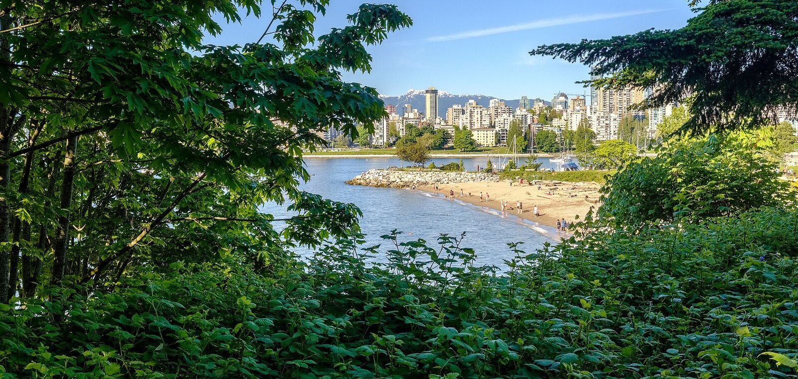
The Vancouver neighbourhoods most visitors should see start on the downtown peninsula (the West End, Coal Harbour, Gastown and Yaletown, with Chinatown next door), cross False Creek to Granville Island and Kitsilano, and then head east for at least one East Van street: Main Street in Mount Pleasant or Commercial Drive. With a spare half-day, North Vancouver is a 12-minute SeaBus ride away and Richmond’s food scene is 25 minutes down the Canada Line.
This guide is for visitors working out where to spend their time, or where to base themselves, and it covers the whole region rather than just the postcard core. The caveat worth knowing up front: “Vancouver” usually means Metro Vancouver, a patchwork of separate cities and districts, and the City of Vancouver is only one of them. Everything below was checked September 25, 2026 against official sources, with travel times given as typical off-peak estimates.
What’s closed or different right now?
- Broadway is a construction zone. The Broadway Subway, a Millennium Line extension running 5 km under Broadway with six new underground stations as far as Arbutus Street, is testing trains and is scheduled to open in fall 2027. Until then, expect lane closures and detours along Broadway through Mount Pleasant, Fairview and into Kitsilano.
- Kits Pool is shut for the season, and its future is open. The saltwater pool’s 2026 season ended on September 13. The City says the pool has reached the end of its functional life, and a replacement is being weighed for its 2027 to 2030 capital plan.
- Two old favourites have moved or stopped. Bright Nights left Stanley Park after December 2024 and now runs at the Cloverdale Fairgrounds in Surrey, and the Stanley Park miniature train hasn’t run since a safety incident that same month.
- Check museum days. Downtown, the Vancouver Art Gallery now closes on Tuesdays. In Chinatown, the Chinese Canadian Museum doesn’t open every day of the week, so check before walking over.
How is Vancouver laid out?
Picture a thumb of land pointing west into the ocean. That’s the downtown peninsula, with Stanley Park at its tip, Burrard Inlet and the North Shore mountains to the north, and the narrow inlet of False Creek to the south. Nearly everything a first-time visitor wants is within a 15-minute walk of that shoreline, which is why so many trips never leave it. They should.
South of False Creek, the city spreads out in a grid. Ontario Street, one block west of Main Street, is the official dividing line between east and west addresses, and it’s also a cultural line. The West Side, from Fairview and Kitsilano out to Point Grey and UBC, is leafier and pricier. East Van, everything east of Main, is where the city’s working-class, immigrant and artistic roots show most, and it’s where locals tend to send you for dinner. The illuminated East Van cross sculpture at Clark Drive and 6th Avenue isn’t subtle about the local pride.
The City of Vancouver itself, home to about 660,000 people at the 2021 census, officially divides into 22 local areas, from the West End and Strathcona to Killarney and Dunbar-Southlands. Around it, Metro Vancouver takes in 21 municipalities, one electoral area and one treaty First Nation, with about 2.6 million people. North Vancouver (confusingly, both a city and a separate district), West Vancouver, Richmond, Burnaby, New Westminster and Surrey are all their own cities with their own town centres, and SkyTrain or the SeaBus reaches most of them in under half an hour. The Vancouver transportation guide covers the connections, and the Vancouver history guide explains how the map got this way.
One thing no map shows: all of it sits on the traditional, unceded territories of the Musqueam, Squamish and Tsleil-Waututh Nations, whose place names are slowly returning to signs across the region.
Which Vancouver neighbourhood suits you?
Use this to pick your half-days. Times are from Waterfront station downtown, off-peak.
| Neighbourhood | Best for | Getting there | Give it |
|---|---|---|---|
| West End | English Bay, Stanley Park, Davie Village | 15 to 25 min on foot | Half a day |
| Coal Harbour | Seawall strolls, floatplanes, harbour views | 10 min on foot | 1 to 2 hours |
| Gastown | Heritage streets, cocktail bars, dinner | 5 min on foot | 1 to 2 hours plus a meal |
| Chinatown and Strathcona | History, the classical garden, bakeries | 15 min on foot, or 5 min by SkyTrain | Half a day |
| Yaletown | Patio dining, the False Creek seawall | 5 min by Canada Line | 1 to 2 hours |
| Granville Island | Public Market, studios, theatre | 20 min by bus, or bus and Aquabus | Half a day |
| Kitsilano | The beach, Vanier Park’s museums, West 4th | 20 min by bus | Half a day |
| Point Grey and UBC | Museum of Anthropology, beaches, forest trails | 35 to 45 min by bus | Most of a day |
| Main Street, Mount Pleasant | Indie shops, breweries, cafés | 15 to 20 min by bus | Half a day |
| Commercial Drive | Italian cafés, cheap eats, people-watching | 12 min by SkyTrain | 2 to 3 hours |
| Punjabi Market | Sweets, saris, South Asian food | 35 min by bus | 1 to 2 hours |
| Hastings-Sunrise | The PNE fair and Playland in late summer | 25 min by bus | An event day |
What are the downtown neighbourhoods like?
Downtown Vancouver is small enough to walk across in 40 minutes, but its neighbourhoods feel distinct within a few blocks. If you’re only here for a weekend, these are where you’ll spend most of it.
West End and Davie Village
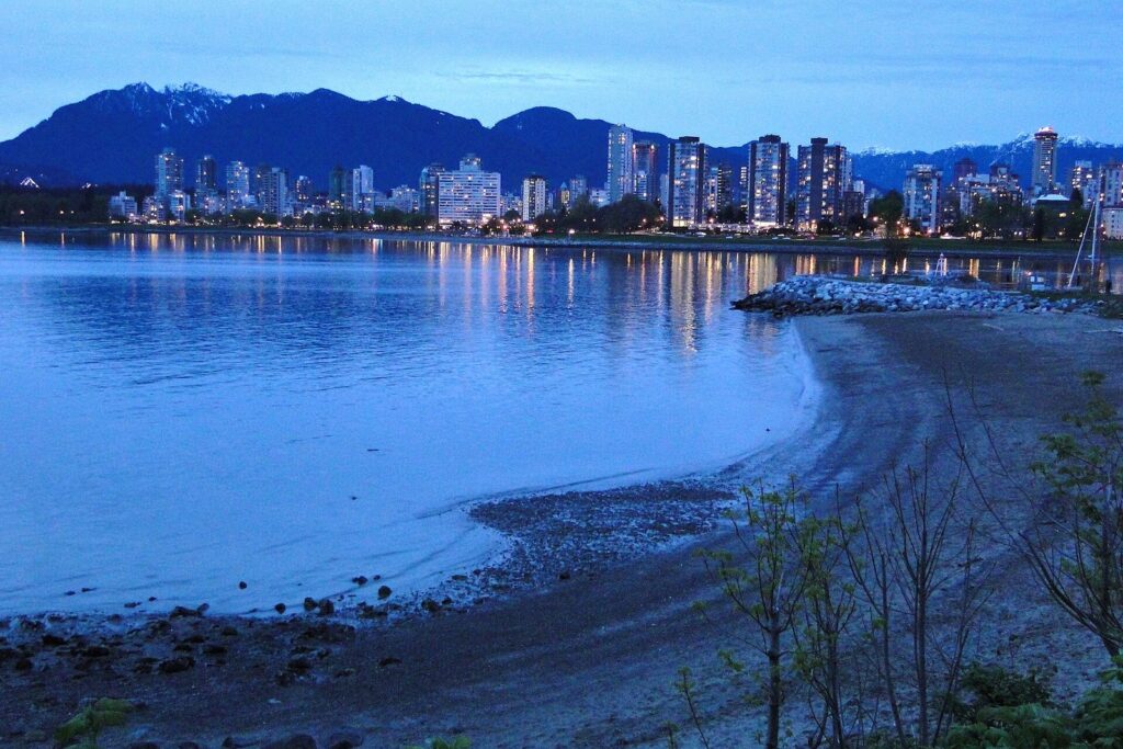
The West End is the residential heart of downtown: a grid of apartment towers, older low-rises and tree-lined streets squeezed between Stanley Park, English Bay and the shopping on Robson Street. It’s one of the most densely populated neighbourhoods in Canada and it still feels relaxed, because the beach and the park are never more than ten minutes away. Denman Street is the place for casual food with a view of the bay at the end. Davie Village, marked by rainbow crosswalks, is the city’s historic LGBTQ+ neighbourhood and the centre of Davie Village nightlife. Sunset at English Bay is the neighbourhood’s daily event, and in late July the Celebration of Light fireworks fill it with crowds. The park at the end of the street gets its own Stanley Park guide.
Coal Harbour
Coal Harbour lines the downtown waterfront between Canada Place and Stanley Park: glassy condo towers, marinas, the Olympic Cauldron at Jack Poole Plaza, and floatplanes landing and taking off right in front of you. It’s polished and quiet rather than lively, and the Seawall through it is the most pleasant way to walk from the cruise terminal to Stanley Park. Most visitors pass through it rather than spend time in it, which is fine.
Gastown
Gastown is where the city began, around a saloon opened by “Gassy” Jack Deighton in 1867. Its cobbled Water Street, brick warehouses and the steam clock (built in 1977, whistling on the quarter hour) are the most photographed blocks in Vancouver, and the souvenir shops on them are the least interesting part. The better Gastown is on the side streets and in the evening: cocktail bars, some of the city’s most ambitious restaurants and design shops in the old warehouses. The Gastown walking guide strings the sights together. Gastown borders the Downtown Eastside, a few blocks of East Hastings where poverty and addiction are concentrated; the Vancouver travel tips guide explains how to walk through it respectfully.
Chinatown and Strathcona
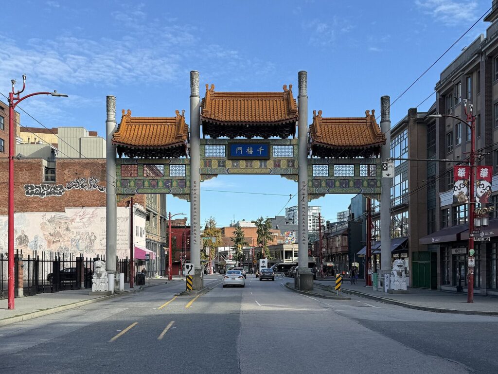
Vancouver’s Chinatown is one of the largest historic Chinatowns in North America and a National Historic Site, entered through the Millennium Gate on Pender Street. Its anchors are the Dr. Sun Yat-Sen Classical Chinese Garden, built by craftspeople from Suzhou and opened in 1986, and the Chinese Canadian Museum, opened in 2023 in the Wing Sang Building, which merchant Yip Sang built in 1889 and which is the oldest brick building in the neighbourhood. Look, too, for the Sam Kee Building on Pender, less than 1.5 m deep, a monument to one merchant’s refusal to be bought out. Old bakeries, herbalists and barbecue shops still hold on alongside newer bars and cafés, and the neighbourhood’s pressures are real, which makes spending money here with the older businesses count. The Chinatown heritage walk and the Dr. Sun Yat-Sen Garden guide go deeper.
East of Chinatown, Strathcona is Vancouver’s oldest residential neighbourhood, a pocket of painted wooden houses, community gardens and small studios. It was also home to Hogan’s Alley, the centre of the city’s Black community until the Georgia Viaduct was built through it around 1970. There’s little to “do” in Strathcona, and that’s the appeal: it’s one of the best neighbourhoods for a quiet walk with a coffee.
Yaletown
Yaletown was a railway warehouse district, and it shows: the old brick warehouses kept their raised loading docks, which now serve as restaurant patios along Mainland and Hamilton streets. The Roundhouse community centre, a former railway turntable building, keeps Engine 374, which pulled the first transcontinental passenger train into Vancouver in 1887, on free display. Walk down to the False Creek seawall at David Lam Park and you can catch the little Aquabus ferries across to Granville Island. Yaletown is at its best for an evening meal outside; by day it’s mostly offices and condos.
What’s on the West Side, across False Creek?
The Vancouver West Side neighbourhoods run from Granville Island and Fairview out to the university at Point Grey. They’re greener, wealthier and more spread out than downtown, with beaches on one side and big parks in the middle, and they’re where Vancouver goes to exercise in public.
Granville Island
Granville Island, tucked under the Granville Bridge, was a gritty industrial site until the 1970s, when it was reinvented as a public market and arts district. The Public Market is the draw: fishmongers, bakers, butchers and produce stalls under one roof, with a waterfront deck outside for eating what you’ve bought. Around it are artisan studios, theatres, a brewery, a kids’ market and the boatyards that still work. It’s busy on summer weekends, so come early on a weekday if you can. Getting there is half the fun: the Aquabus and False Creek Ferries cross from downtown in a few minutes. The Granville Island guide has the full rundown.
Kitsilano
In Kitsilano Vancouver goes to the beach. Kits Beach faces the downtown skyline across English Bay, with volleyball nets, a long lawn and the outdoor saltwater pool (closed for the season, as above). Vanier Park, at the neighbourhood’s eastern edge, holds the Museum of Vancouver, the H.R. MacMillan Space Centre and the Vancouver Maritime Museum, and in summer the Bard on the Beach Shakespeare festival pitches its tents there. Inland, West 4th Avenue is a long strip of cafés, outdoor-gear stores and brunch spots; the neighbourhood’s 1960s counterculture past is part of the Greenpeace origin story. If you’re thinking of basing yourself here, see staying in Kitsilano.
Point Grey and UBC
Point Grey is where the city runs out of land. Jericho, Locarno and Spanish Banks beaches line its north shore, with tidal flats at Spanish Banks that stretch far out at low tide. Beyond them sits the University of British Columbia, which isn’t technically in the City of Vancouver but is essential: the Museum of Anthropology is the best museum in the region, and the campus also holds the Beaty Biodiversity Museum, the UBC Botanical Garden and Nitobe Memorial Garden. Between campus and city lies Pacific Spirit Regional Park, a huge second-growth forest crossed by quiet trails. Below the cliffs is Wreck Beach, which is clothing-optional and reached by a long staircase. Note that none of this is in West Vancouver, which is across the water on the North Shore.
South Granville, Fairview and Shaughnessy
South Granville, the stretch of Granville Street climbing south from the bridge, is the city’s gallery row, with art dealers, design stores and the Stanley, one of the Arts Club Theatre Company’s stages. Fairview, around it, is mostly hospitals, offices and apartment blocks, and currently the heart of the Broadway construction. Uphill to the south, Shaughnessy was laid out by the Canadian Pacific Railway in the early 1900s for the city’s elite, and its curving streets of mansions behind hedges make an interesting, if slightly voyeuristic, walk on the way to VanDusen Botanical Garden and Queen Elizabeth Park, the city’s highest point.
Kerrisdale, Dunbar and the Arbutus Greenway
Kerrisdale and Dunbar are the West Side’s village-style shopping streets, full of bakeries, bookshops and older residents, and they’re the sort of place you only reach on purpose. The easiest way to see them is on the Arbutus Greenway, a former rail line turned into a walking and cycling path that runs about 9 km from False Creek south toward the Fraser River, passing gardens and backyards most visitors never see.
Why do locals send you to East Van?
Ask a Vancouverite where to eat, drink or shop, and the answer is usually somewhere in East Vancouver. The neighbourhoods east of Main Street are less polished, cheaper, more diverse and more fun, with independent businesses on almost every block.
Main Street and Mount Pleasant
Main Street, from roughly 2nd Avenue up to the 30s, is the spine of Mount Pleasant and Riley Park: vintage and design shops, record stores, cafés and some of the city’s best-value restaurants. In Mount Pleasant Vancouver has its densest cluster of craft breweries, in the old light-industrial blocks around Main and 7th, on land once known as Brewery Creek for the breweries that drew water from the stream in the 1800s. The building walls around it double as a gallery of large murals. The East Van brewery crawl maps a route. At the north end, Main Street meets False Creek at Science World and the former Olympic Village.
Commercial Drive
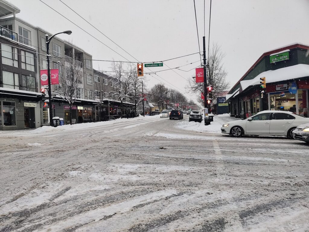
“The Drive” is Vancouver’s Little Italy, settled by Italian immigrants after the Second World War, and its old espresso bars still set the tone. On Commercial Drive Vancouver shows its mix better than anywhere else: Portuguese bakeries, Ethiopian and Mexican restaurants, organic grocers and pubs share the street with the Italian cafés, and the crowd at Grandview Park takes in everyone. It’s at its best on a sunny Saturday afternoon or during the June Italian Day street festival. The Commercial-Broadway SkyTrain station at its south end makes it the easiest East Van neighbourhood to reach.
Hastings-Sunrise and Fraser Street
Hastings-Sunrise, in the city’s northeast corner, is worth the trip for Hastings Park, home of the PNE fair from late August to Labour Day and the Playland amusement park, and for the old Italian delis on East Hastings. New Brighton Park, on the water nearby, has an outdoor pool in summer. Farther south, Fraser Street, nicknamed “Fraserhood”, has turned into one of the city’s more interesting casual-restaurant strips over the past decade.
Keep going southeast and the city’s newer immigrant communities take over the storefronts. Kingsway, the old diagonal highway to New Westminster, is lined with Vietnamese noodle shops, Chinese bakeries and Korean grills, few of them fancy and many of them excellent. Around Joyce-Collingwood SkyTrain station, Filipino bakeries and grocers give the blocks a character you won’t find in any guidebook’s top ten. None of this is sightseeing in the usual sense, but if you like eating your way through a city, it’s where the value is.
What’s worth seeing in South Vancouver?
South Vancouver is residential and rarely makes the tourist maps, but two places deserve a detour.
Punjabi Market
On Main Street between about 48th and 51st Avenues, the Punjabi Market has been the commercial heart of the city’s Punjabi Sikh community since the 1970s. The Punjabi Market Vancouver knows today is smaller than in its heyday, when it was the largest South Asian market district in North America, but it still has sweet shops stacked with jalebi and barfi, sari and fabric stores, gold jewellers and excellent, inexpensive restaurants. A few blocks west, the Ross Street Sikh temple, designed by Arthur Erickson, is where the city’s Vaisakhi parade begins and ends each April.
Marpole and the Fraser River
At the city’s southern edge, Marpole sits on c̓əsnaʔəm, an ancient Musqueam village and burial site that is now a National Historic Site, a reminder of how long people have lived at the mouth of the Fraser. The Musqueam Indian Reserve lies just west, and the Vancouver culture and history guide covers Indigenous-led ways to learn more. For visitors, the riverfront parks here are pleasant, and the neighbourhood’s main use is as the jumping-off point for Richmond.
Which Metro Vancouver cities are worth the trip?
The surrounding cities aren’t suburbs in the dull sense. Each has at least one thing the City of Vancouver can’t match, and several are faster to reach than some corners of the city itself.
| City | Known for | How to get there | Time from downtown |
|---|---|---|---|
| North Vancouver | Lonsdale Quay, the Shipyards, canyons, Grouse Mountain | SeaBus | 12-minute crossing |
| West Vancouver | Seaside walks, Lighthouse Park, Horseshoe Bay | Bus or car | 25 to 45 min |
| Richmond | Chinese food, Steveston, the summer night market | Canada Line | 25 min |
| Burnaby | Metrotown shopping, Deer Lake, Burnaby Mountain | Expo Line | 20 min to Metrotown |
| New Westminster | Riverfront quay, heritage streets | Expo Line | 25 to 30 min |
| Port Moody | Brewers Row, Rocky Point Park | Millennium Line | 40 to 45 min |
| White Rock | The pier, the promenade, sandy beaches | Car, or Canada Line and bus | 45 to 60 min by car; 75 to 90 by transit |
North Vancouver
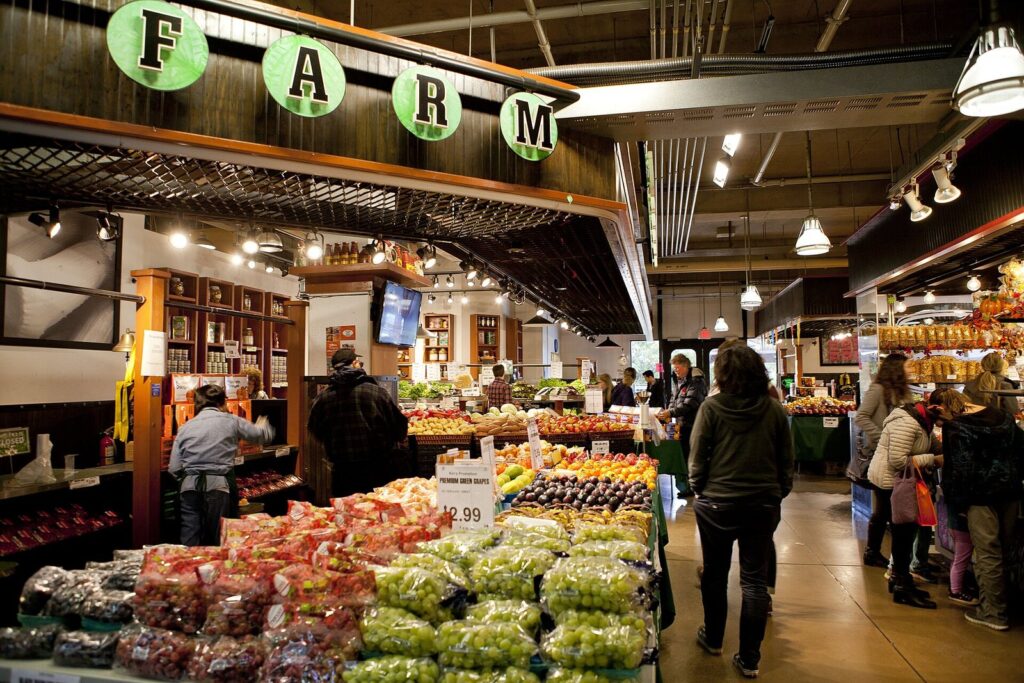
North Vancouver is two municipalities: the compact City of North Vancouver around Lonsdale Avenue, and the much larger District of North Vancouver that wraps around it into the mountains. The SeaBus drops you at Lonsdale Quay, whose market hall is good for lunch, next to the Shipyards, a waterfront plaza with summer night markets, a winter skating rink and the Polygon Gallery for photography. The district side holds the big-ticket nature: the Capilano Suspension Bridge, Grouse Mountain, Lynn Canyon and the kayaking village of Deep Cove. The shortlist of North Vancouver things to do is long enough to fill two days, and the Vancouver outdoors guide covers its trails.
West Vancouver
West Vancouver is the North Shore’s wealthier, quieter half. Its seawalk runs along the water between Ambleside and Dundarave, both small beach villages with cafés, and farther west come Lighthouse Park‘s old-growth forest and the ferry terminal at Horseshoe Bay, where boats leave for Bowen Island, Nanaimo and the Sunshine Coast. It’s a lovely half-day with a car, and a slow one by bus.
Richmond
Richmond sits on the islands of the Fraser River delta, including Sea Island, home of the airport. Its large Chinese-Canadian community makes it one of the best places in North America for Cantonese, Shanghainese, Taiwanese and Sichuan cooking, much of it in the malls and plazas along the Canada Line near No. 3 Road. Most Richmond BC things to do come back to food: the dumpling trail, the dim sum halls (see the best dim sum guide) and, on summer weekends, the night market. At its southwest corner, the old fishing village of Steveston has a working harbour, a cannery museum and fish and chips on the dock; the Steveston day trip guide covers it.
Burnaby
Burnaby, directly east of Vancouver, is best known for Metropolis at Metrotown, the province’s biggest mall, but its better side is green. Deer Lake Park has a lakeside trail, an art gallery and the Burnaby Village Museum, a recreated early-1900s town with a vintage carousel. Burnaby Mountain, topped by Simon Fraser University’s concrete campus, has one of the best views in the region west over the inlet. Burnaby things to do suit a half-day by SkyTrain, especially with kids or on a rainy day at the mall.
New Westminster
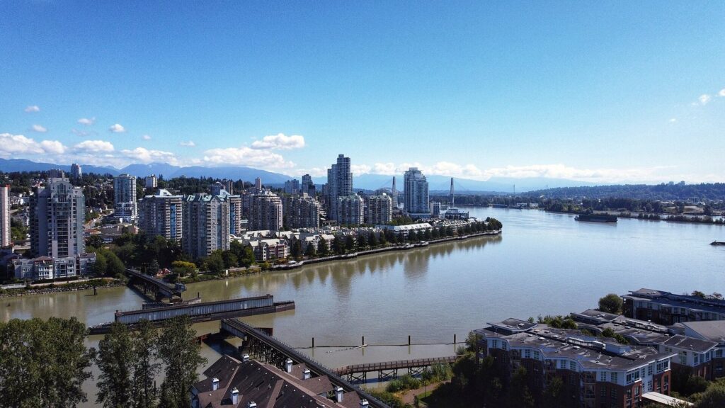
New Westminster, the “Royal City”, was the first capital of the colony of British Columbia and is older than Vancouver itself. Its riverfront Quay has a boardwalk along the Fraser, a market building and a giant tin soldier, and uphill, Columbia Street’s heritage buildings hold antique shops, bridal stores and restaurants. The best New Westminster things to do are low-key: a river walk, a meal, a look at the working river traffic. It’s an easy trip on the Expo Line, with the station steps from the water.
Surrey and White Rock
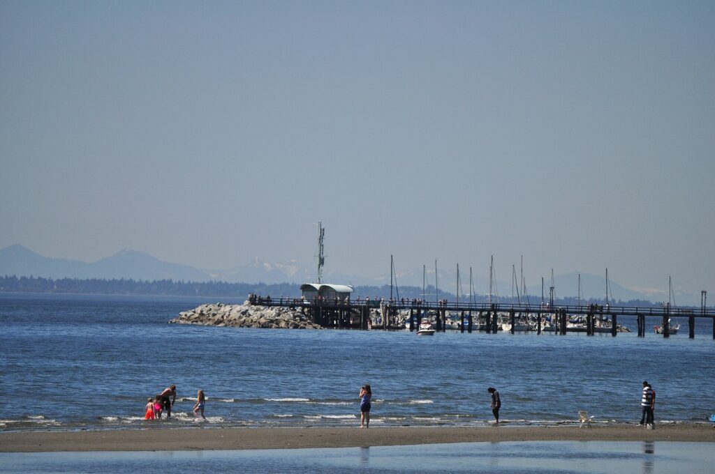
Surrey, the region’s second-largest city, is spread wide and is best visited for specific things: the Cloverdale Fairgrounds, now home to Bright Nights in December; Crescent Beach; and one of the largest Vaisakhi parades outside India each April. At Surrey’s southern edge, the small seaside city of White Rock is named for a large white boulder on its beach. White Rock BC things to do mostly come down to one pleasant afternoon: walking the long wooden pier over Semiahmoo Bay, then the promenade, then fish and chips on Marine Drive. It’s about 10 minutes from the Peace Arch border crossing, so it also makes a good last stop on the way to Seattle.
Port Moody and farther afield
Port Moody, at the head of Burrard Inlet and the end of the Millennium Line’s newer branch, has a row of craft breweries on Murray Street and the waterfront Rocky Point Park. Farther east, the village of Fort Langley, about an hour’s drive from downtown, is where British Columbia was proclaimed a colony in 1858, and it’s now a National Historic Site with a riverside main street. For fuller day-trip plans, see the day trips from Vancouver guide.
Which neighbourhoods match your interests?
If you’d rather choose by what you like doing than by the map, this is the short version.
| If you love | Go to | Why |
|---|---|---|
| Beaches and sunsets | West End, Kitsilano, Point Grey | English Bay, Kits Beach and Spanish Banks, all facing west |
| Chinese food | Richmond, Chinatown | Regional cooking from across China, plus Chinatown’s old bakeries |
| Craft beer | Mount Pleasant, Port Moody | Two walkable brewery clusters |
| Independent shopping | Main Street, Commercial Drive, West 4th | Vintage, design and outdoor-gear shops rather than chains |
| History | Gastown, Chinatown, New Westminster | The oldest streets in the region |
| Forest and trails | North Vancouver, Point Grey | Canyons, mountains and Pacific Spirit’s trails |
| Nightlife | Gastown, Granville Street, Davie Village | Cocktail bars, clubs and the city’s LGBTQ+ strip |
| Travelling with kids | Granville Island, Kitsilano, Burnaby | The Kids Market, beaches and Burnaby Village Museum |
Can you see several neighbourhoods in one day?
Easily, if you string them together along the water or a transit line rather than zigzagging. Two routes that work:
- The False Creek loop. Start with breakfast at the Granville Island Public Market, walk west along the seawall to Kitsilano Beach and Vanier Park, then catch a bus up to West 4th for lunch. In the afternoon, take a bus east to Main Street for shops and a brewery, and finish with dinner on Commercial Drive, one SkyTrain stop from home if you’re staying downtown.
- The North Shore and back. Take the SeaBus to Lonsdale Quay for a late breakfast, bus to Lynn Canyon or Deep Cove for a walk in the forest, and ride back across the water at sunset. Spend the evening in Gastown, a five-minute walk from the SeaBus terminal at Waterfront.
What doesn’t work is trying to add Richmond, White Rock or Burnaby to a day that already includes the North Shore. The region is bigger than it looks from the Seawall, and each extra city costs an hour of travel. Pick one direction per day and let the neighbourhoods on that side fill it.
Which neighbourhood should you stay in?
For a first trip, stay downtown: the West End for beaches and a residential feel, Coal Harbour for quiet and views, Gastown or Yaletown for restaurants on your doorstep, or near Waterfront station if you’re catching a cruise. Kitsilano suits a longer, slower stay with a beach habit, and Richmond is worth considering if food is the point of the trip or you have an early flight. The where to stay in Vancouver guide compares each area with hotels at every budget, and there are detailed guides to the West End, Coal Harbour, Gastown and Yaletown.
Vancouver neighbourhoods FAQ
What is the best neighbourhood in Vancouver for tourists?
For a first visit, the West End is hard to beat: it sits between Stanley Park, English Bay and downtown’s shops, it’s residential enough to feel real, and almost everything is walkable. Coal Harbour is quieter and pricier, while Gastown and Yaletown suit visitors who care most about restaurants and bars on the doorstep. Kitsilano is the best pick outside downtown.
What is East Van?
East Van, or East Vancouver, is the half of the city east of Main Street, officially divided from the West Side at Ontario Street. It includes Mount Pleasant, Commercial Drive, Strathcona, Hastings-Sunrise and much of South Vancouver. It’s generally less expensive and more diverse than the West Side, and it’s where many locals go for food, breweries and independent shops.
Is Richmond part of Vancouver?
Not officially. Richmond is a separate city within Metro Vancouver, directly south of the City of Vancouver across the Fraser River’s north arm. The airport is on Richmond’s Sea Island, and the Canada Line SkyTrain connects Richmond’s centre to downtown Vancouver in about 25 minutes, so for visitors it behaves like part of the city.
Which Vancouver neighbourhoods should you avoid?
No neighbourhood is off-limits to visitors, but the Downtown Eastside, a few blocks of East Hastings around Main Street between Gastown and Chinatown, has concentrated homelessness and open drug use. Walking through in daylight is routine; after dark, most visitors prefer busier parallel streets such as Water Street or Pender. Elsewhere, ordinary city sense applies.
How many neighbourhoods does Vancouver have?
The City of Vancouver officially divides itself into 22 local areas, such as the West End, Kitsilano, Mount Pleasant and Strathcona. Locals also use dozens of informal names for smaller districts within them, like Yaletown, Coal Harbour, Gastown, Chinatown, Davie Village and the Punjabi Market, which are the names you’ll see on signs and menus.
Is North Vancouver worth visiting?
Yes, and it’s easier than it looks. The SeaBus crosses from Waterfront station to Lonsdale Quay in about 12 minutes on a regular transit fare, and from there buses reach Lynn Canyon, Deep Cove, Grouse Mountain and the Capilano Suspension Bridge. Even a two-hour round trip for lunch at the Quay gives you the best harbour views of downtown.
Related Vancouver guides
- Things to Do in Vancouver: the attractions in each neighbourhood, ranked by what they’re worth
- Where to Eat in Vancouver: the food that makes the neighbourhoods worth crossing town for
- Vancouver Nightlife: bars and breweries from Gastown to East Van
- Vancouver Itinerary: day-by-day plans that link the neighbourhoods together
- Downtown Vancouver Hotels: where to stay in the core, by street and budget
Sources and verification
Checked on September 25, 2026 against the agencies and institutions listed below. This guide was compiled from their published information rather than from other travel lists, and it doesn’t claim first-hand visits. Travel times are typical off-peak estimates and vary with traffic and connections.
- TransLink: Broadway Subway Project
- Province of British Columbia: Broadway Subway train testing (2026)
- City of Vancouver: Planning for the future of Kitsilano Pool; Kitsilano Pool 2026 season
- Chinese Canadian Museum: The Wing Sang Building; Plan your visit
- Vancouver Art Gallery: Hours and admission
Photo credits
- West End from Kitsilano Beach at dusk (2010): photo by Adam Jones, Ph.D., Wikimedia Commons (CC BY-SA 3.0)
- Chinatown Millennium Gate (2025): photo by Canmenwalker, Wikimedia Commons (CC BY 4.0)
- Commercial Drive in snow (2020): photo by Emma0mb, Wikimedia Commons (CC BY 4.0)
- Lonsdale Quay Market (2015): photo by GoToVan from Vancouver, Canada, Wikimedia Commons (CC BY 2.0)
- New Westminster Quay (2020): photo by Dennis Sylvester Hurd, Wikimedia Commons (CC BY 2.0)
- White Rock pier (2013): photo by Joe Mabel, Wikimedia Commons (CC BY-SA 3.0)
- Kitsilano Beach and downtown (featured image): photo by Xicotencatl, Wikimedia Commons (CC BY-SA 4.0)